Shiga Kogen is known as one of Japan’s largest and highest altitude ski resorts. But there’s plenty more to this region than just its powder snow. During summer, when most of the white stuff has melted from the mountains, you can enjoy hiking through highland marshes and forests at altitudes above 2,000 meters high.
See some of Shiga Kogen's most memorable nature and hiking trails below.
Nature and Hiking Trails in Shiga Kogen
Shiga Kogen’s Forest Therapy Road
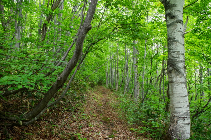
Tucked away behind the Okushiga Kogen area of Shiga is a tranquil trail through highland woods. A certified forest therapy course, it takes about an hour and a half to complete at a leisurely pace.
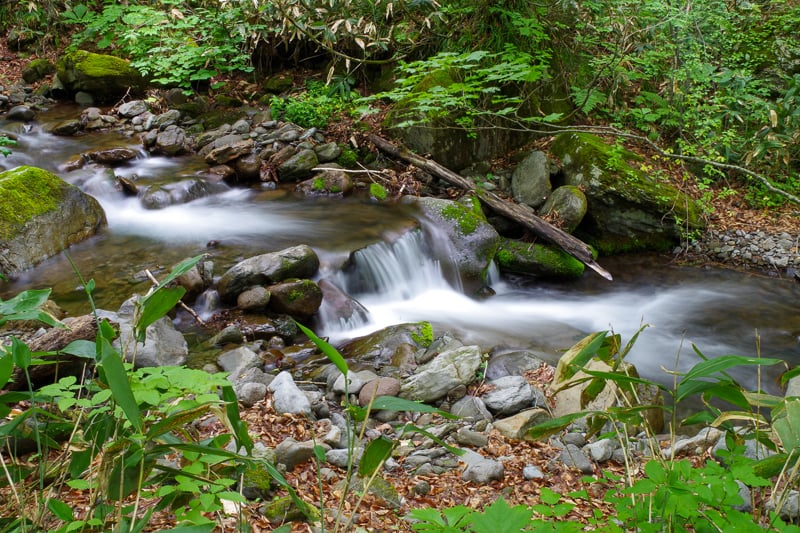
As you slowly descend into the heart of nature, your senses will be awash with relaxing noises and beautiful sights. You can hear bird song intermingled with the running water of nearby ravines. You can see rays of sunlight filtering through the verdant canopy, casting mottled patterns of leaves on the ground. Just beside the trail, you’ll find green carpets of moss, bright alpine flowers and mushrooms.
There’s no rush to complete the course. Take your time, relax at one of many benches found around the trail and focus on forest-bathing.
Details
Distance: 3.3km
Time: 1 hour 20 minutes
Starting Point: Okushiga Kogen (Okushiga Kogen Hotel bus stop)
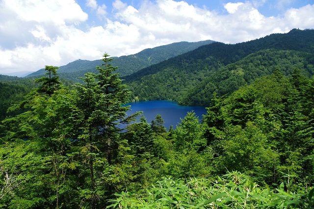
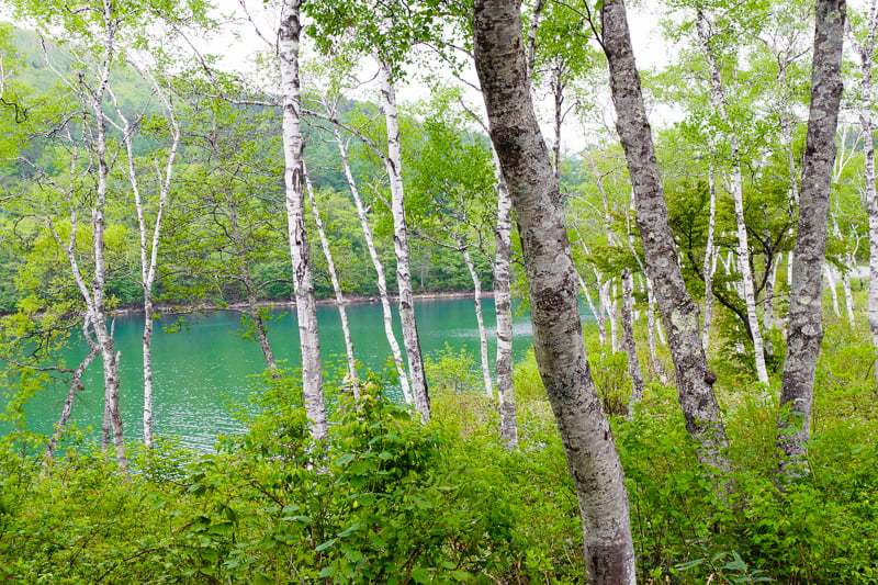
The Ikemeguri Trail and Onuma Pond
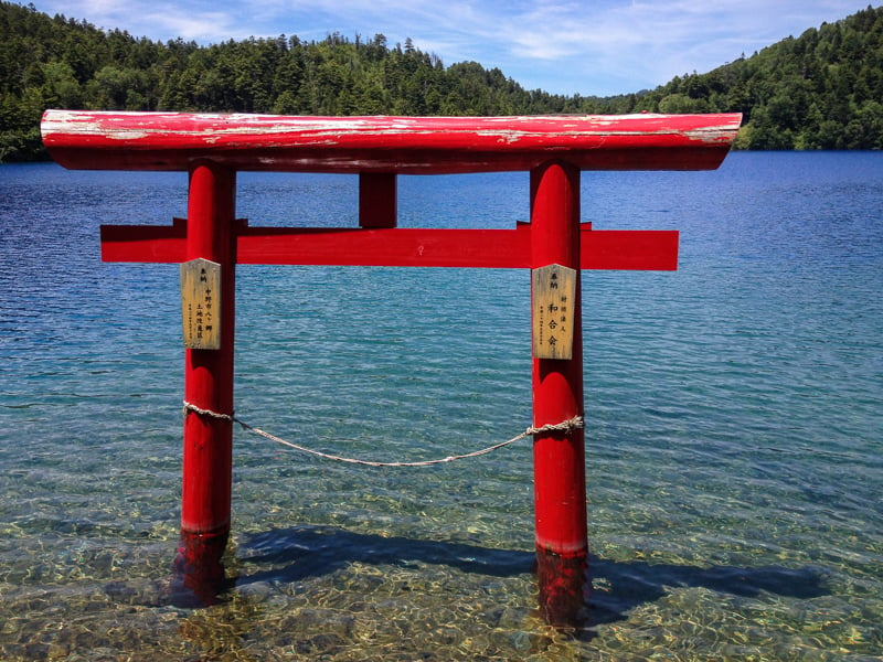
The Ikemeguri trail is Shiga Kogen’s representative hike, winding through the precious marshlands of Shijuhachiike on its way to cobalt blue Onuma Pond. The trail also branches out to several nearby mountain peaks, namely Mts. Shiga, Urashiga and Akaishi, that offer spectacular views of the whole region.
Beginning from the Maeyama lift by the Kumanoyu ski area, the trail passes Shibu Pond and soon enters Shijuhachiike. A long, flat boardwalk extends across the marsh towards Mt. Shiga. Hidden within the tall grasses here, you’ll find precious alpine flora and fauna. Eventually, the trail descends flights of long steps towards Onuma Pond, the trees occasionally dispersing to reveal your destination below.
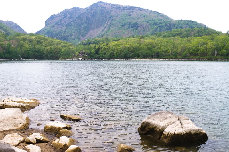
The striking color of Onuma Pond is one of the highlights of the hike. Its electric blue hue is due to the concentration of sulfates in the water, deposited by nearby mineral springs. The contrast of the water and the vermillion torii gate at its shore is sublime.
Details
Distance: 9.6km
Time: 3.5 hours
Starting Point: Maeyama Ski Lift (Hotaru Onsen Bus Stop)
Ending Point: Onuma Pond Entrance (Onuma Iriguchi Bus Stop)
More info: See here
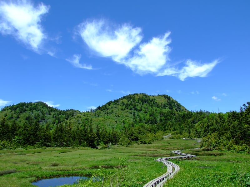
The Sunshine Trail
The Sunshine trail wraps around Biwa Pond, the second largest body of water in Shiga Kogen, and branches off towards two other ponds, Mizunashi and Ichinuma. The well-maintained trails here are relatively flat and easy to walk on, so just about anyone can enjoy a stroll in Shiga Kogen’s pristine nature.
Mt. Asahi (1524m) stands over the pond and is just a 15-minute climb from the water’s edge. From there, you can get a better look at the surrounding mountains as well as the pond itself.
After you’re done walking the trail, you can head back to Yama no Eki for coffee, snacks, or even some delicious ramen from Taishoken. Take some time to view Shiga’s Higashidate Area from the gondola-platform-turned-observation-deck before catching a bus back down into Yamanouchi.
Details
Distance: 3.3km
Time: 1 hour 10 minutes
Starting Point: Shiga Kogen Yama no Eki (Yama no Eki bus stop)
The Mt. Kasagatake Climb
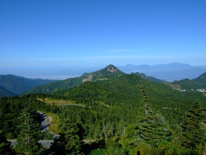
Mt. Kasagatake (2075m) stands on the edge of Shiga Kogen, overlooking the village of Takayama and Matsukawa Gorge. At its base extends the ski resort of Kumanoyu. From the resort, you can climb to the top of this pyramidal peak in about two hours.
The hike slowly ascends the grassy slopes of the ski resort and wraps around the mountain, leading to the Toge-no-Chaya resthouse. From here, you’re greeted by a steep stair climb nearly to the top, followed by a final section of large boulders.
You’re sure to work up a sweat, and what better way to clean off after a hike than a hot spring bath? There are several hotels with hot springs back in the resort area, most notably Kumanoyu Hotel and its jade green hot spring waters.
Details
Distance: 7km
Time: 4 hours
Starting Point: Kumanoyu Ski Resort (Kumanoyu Bus Stop)
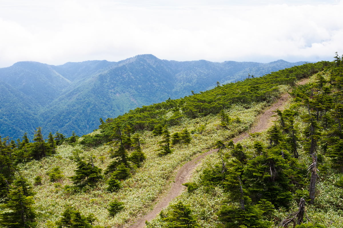
The Mt. Iwasuge Climb
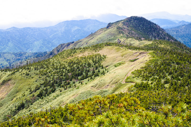
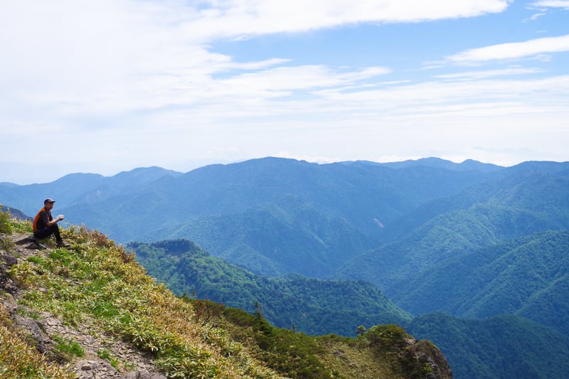
Mt. Iwasuge is part of the ridgeline that runs along the back of Shiga Kogen, stretching as far north as the valley of Akiyamago. From the peak, you can gaze into a pristine valley of virgin forest to the east, and the Yakebitai and Okushigakogen areas of Shiga to the west. Far in the distance, you can even see the glittering peaks of the Northern Japanese Alps.
The trail to Mt. Iwasuge is longer than many of the other trails in Shiga, but the views are worth the trek. From the top of the Higashidate gondola lift, it takes about 3.5 hours to reach Mt. Iwasuge. Hikers can then take Araitazawa route down the mountain and end at Ichinose in about 3 more hours.
Further along the ridgeline is Mt. Uraiwasuge, Shiga Kogen’s tallest peak at 2,341 meters high. It is only 40 to 50 minutes to reach Mt. Uraiwasuge from Mt. Iwasuge, all the while enjoying spectacular scenery. If you have the time and energy, don’t miss bagging this peak as well.
Details
Distance: 18.5km
Time: 7.5 hours
Starting Point: Takamagahara Summer Lift (Takamagahara Onsen Bus Stop)
Ending Point: Ichinose (Ichinose Ski Resort Bus Stop)
More info: See here
Yokoteyama Panorama Course
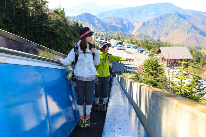
For those who want to enjoy some of Shiga Kogen’s best scenery without breaking a sweat, we recommend the Yokoteyama Panorama Course. This course involves little to no walking at all—instead, you’re whisked to the top by an outdoor escalator and ski lift in just 11 minutes.
At the top of Mt. Yokote, Shiga’s second tallest (2,307m) but most well-known mountain, you can see incredible views of the sprawling highlands. Mt. Kasagatake stands proudly below, and in the distance, you can see the glittering peaks of the Japanese Alps.
On the other side of Mt. Yokote is the Shibu Toge ski area, whose “Romance” pair lift runs during summer, letting you leisurely enjoy the views of alpine flowers growing on the slopes below.
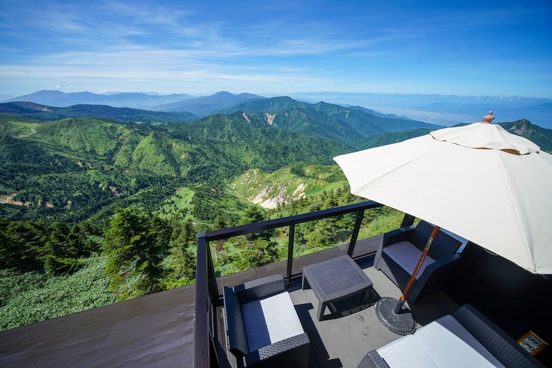
If you’re hungry, you can have a bite to eat or enjoy a drink at the Crumpet Café right above the lift station. The mountaintop’s best viewpoint, the Manten Terrace, is conveniently located right outside!
Details
Distance: 1.5km
Time: 1 hour
Starting Point: Yokoteyama Skylator (Nozoki Bus Stop)
Access to Shiga Kogen
Shiga Kogen sits atop the town of Yamanouchi in northern Nagano, and is accessible by bus from JR Nagano Station or Nagano Dententsu Yudanaka Station. Each of these buses passes the Snow Monkey Park bus stop and continues up to the Yama no Eki bus stop (consider this the main Shiga Kogen bus hub) then splits, either heading towards Okushiga Kogen or Yokoteyama/Shibu Toge.
See bus timetables for each bus at the links below:
Nagano–Shiga Kogen bus
Yudanaka Station–Yokoteyama bus
Yudanaka Station–Okushiga Kogen Bus