The Northern Japanese Alps are home to some of Japan’s tallest mountains and are nestled between the prefectures of Nagano, Niigata, Toyama and Gifu.
All manner of hiking routes cut through the forests and climb to the mountain tops with fabulous views awaiting those willing to make the trek. Among them, one of the most stunning is the Panorama Ginza Route (or Omote Ginze Route).
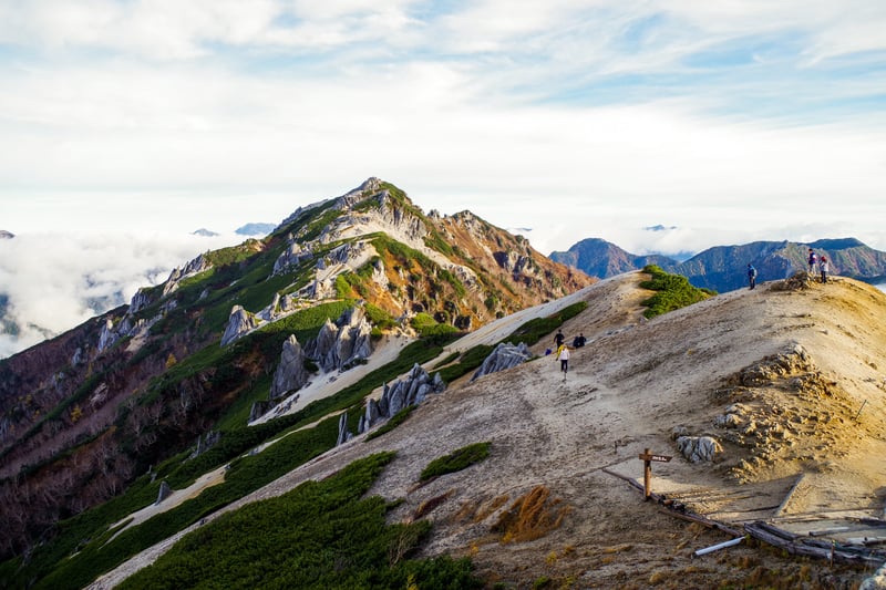
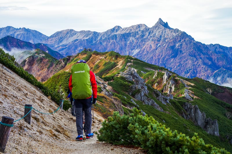
As you walk along its winding ridgeline, the spear-like peak of Mt. Yari ever stands by your side. Below, you can see amazing views of Kamikochi, the other mountains of the Japanese Alps and even Mt. Fuji! And if you’re lucky, Azumino to your left will be covered in a sea of clouds.
Traversing the Panorama Ginza Route
The trek across the Panorama Ginza route takes four days to complete, spanning numerous peaks including Mt. Tsubakuro, Mt. Otensho, Mt. Jonen and Mt. Chogatake.
The route can start from several different trailheads, first climbing either Mt. Chogatake or Mt. Tsubakuro. In this version, we begin from the Nakabusa Onsen trailhead to Mt. Tsubakuro and end at the Mitsumata Trailhead beneath Mt. Chogatake, for a total length of about 27 kilometers.
Schedule
| Day 1 | Nakabusa Onsen to Mt. Tsubakuro | ~5km | 5 Hours |
|---|---|---|---|
| Day 2 | Mt. Tsubakuro to Jonengoya Hut | ~10km | 6.25 Hours |
| Day 3 | Jonengoya Hut to Mt. Chogatake | ~6.5km | 4 Hours |
| Day 4 | Mt. Chogatake to Mitsumata Trailhead | ~5.5km | 3.5 Hours |
Day 1: Nakabusa Onsen to Mt. Tsubakuro
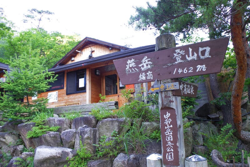
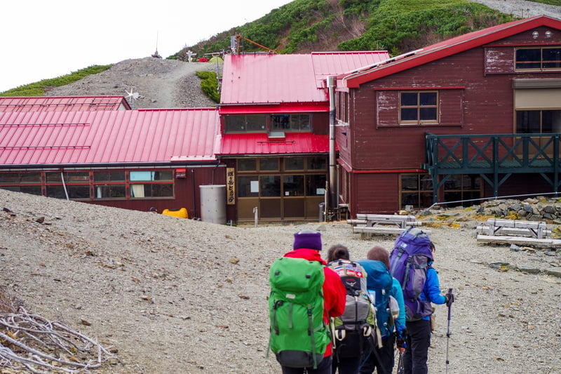
The first stop on the Panorama Ginza route is 2,763-meter-high Mt. Tsubakuro. From the trailhead at Nakabusa Onsen, it can take 4.5 to 6 hours depending on your level of fitness. The trail has a vertical gain of 1,300 meters, so there are some steep sections along the way. But once you reach the top of the mountain, you’ll be rewarded with amazing views of Mt. Yari and the Japanese Alps, as well as Mt. Tsubakuro’s gallery-like arrangement of granite boulders.
Enzanso
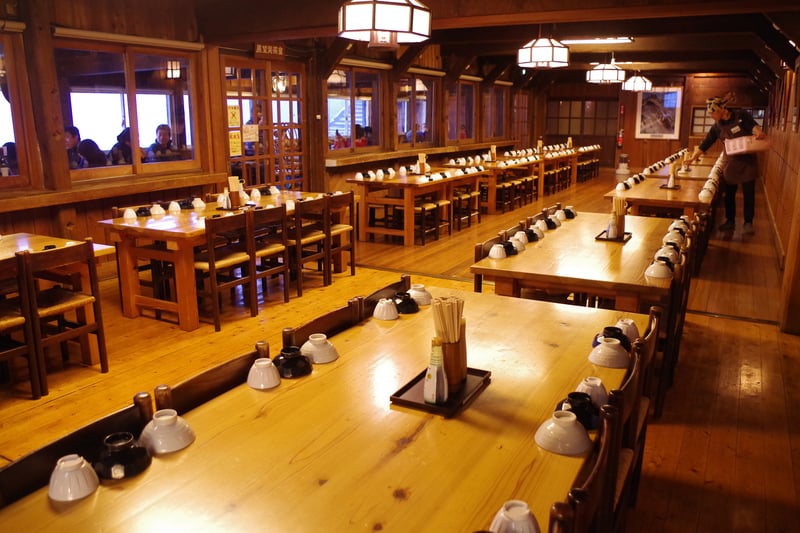
The lodge here, Enzanso, is another highlight of the journey. This giant mountain hut has a capacity of 650. It has a comfortable and cozy wooden interior with large dorm halls and spacious cafeteria. Behind the cafeteria is the lodge’s café, whose windows overlook the Azumino side of the mountain. It’s a great place to enjoy some coffee and cake after a long day of mountain climbing.
Day 2: Tsubakuro to Mt. Jonen
The trail to Mt. Jonen runs southward along the Panorama Ginza ridgeline, summiting Mt. Otensho, the tallest peak of the trail, in the process.
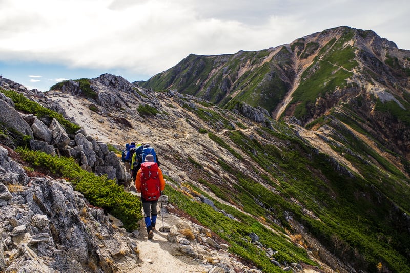
The day’s hike begins relatively easy with a gentle traverse, then dipping down to a technical section with chains and stairs at the base of Otensho. The ascent is steep and tiring, scrambling up loose rocks and gravel for about 45 minutes.
At the top of the mountain is Daitenso Hut—a perfect place to stop for lunch. They have a range of typical Japanese mountain meals (think comfort foods like curry, tonkatsu, etc.) as well as Indian curry and naan.
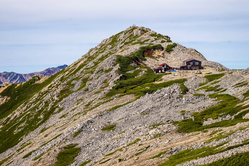

Having summited the highest peak of the Panorama Ginza route, you would think that the rest of the journey would be a piece of cake—unfortunately, there are still many descents and climbs along the way. Still, the rest of this day’s hike is decidedly downward. While slowly descending Mt. Otensho and heading to Jonen, you can enjoy the uninterrupted views of Mt. Yari and the Alps. The Jonengoya Hut is about 2.5 to 3 hours from the top of Otensho.
Jonengoya
The Jonengoya mountain hut sits in a trough between Mt. Jonen and Mt. Yokotoshi, facing Mt. Yari to the west. The hut can fit up to 180 people and has plenty of room for tents out in front.
Day 3: Mt. Jonen to Chogatake
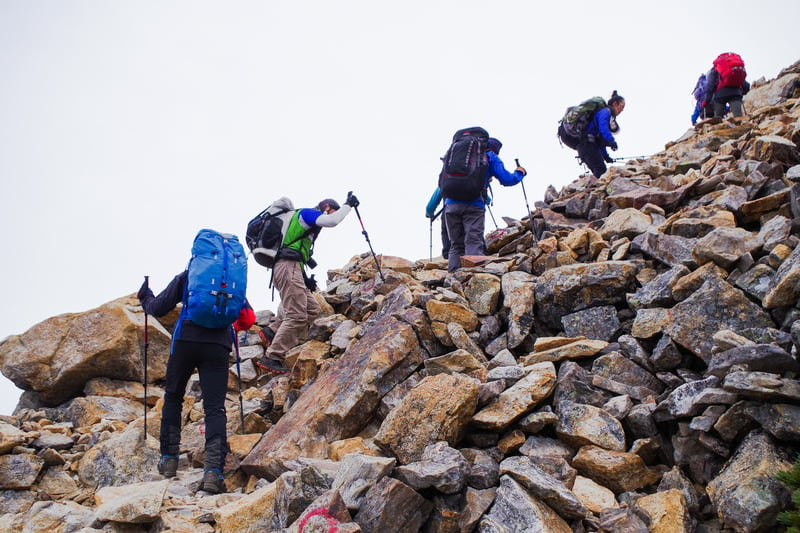
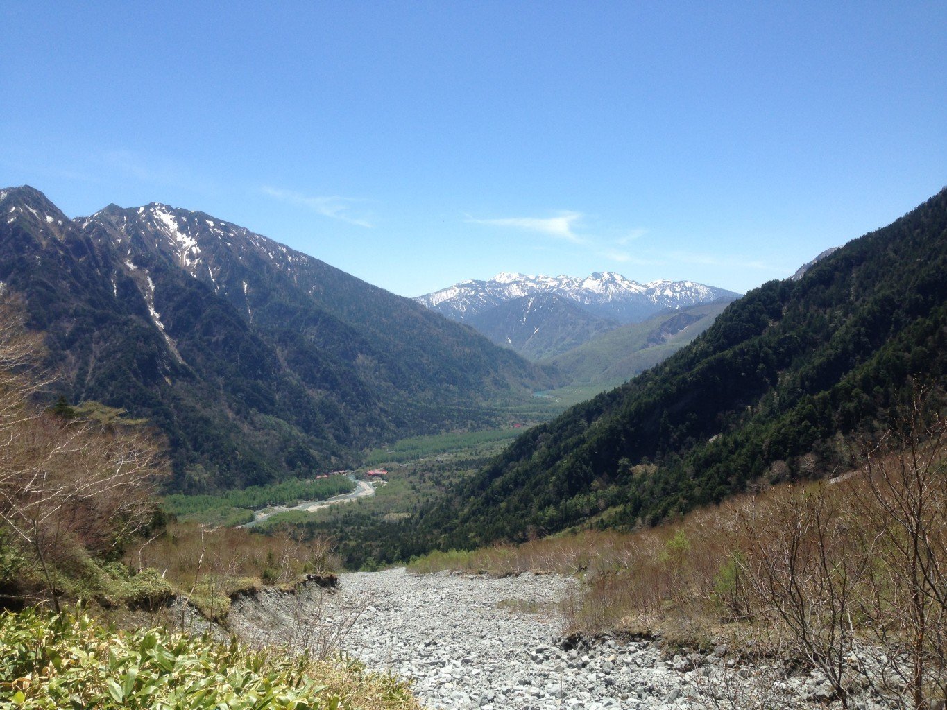
The beginning of day 3 pulls no punches, starting with a steep and rocky hour-long climb to the top of Mt. Jonen. Once you do arrive at the top, you’ll have reached the highest point for the day and be able to see panoramic views of the mountains as well as your first good look into the Kamikochi basin below.
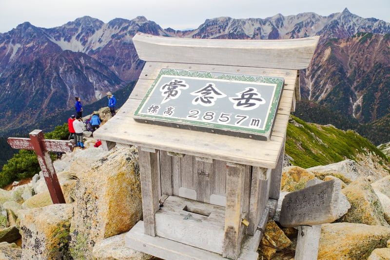
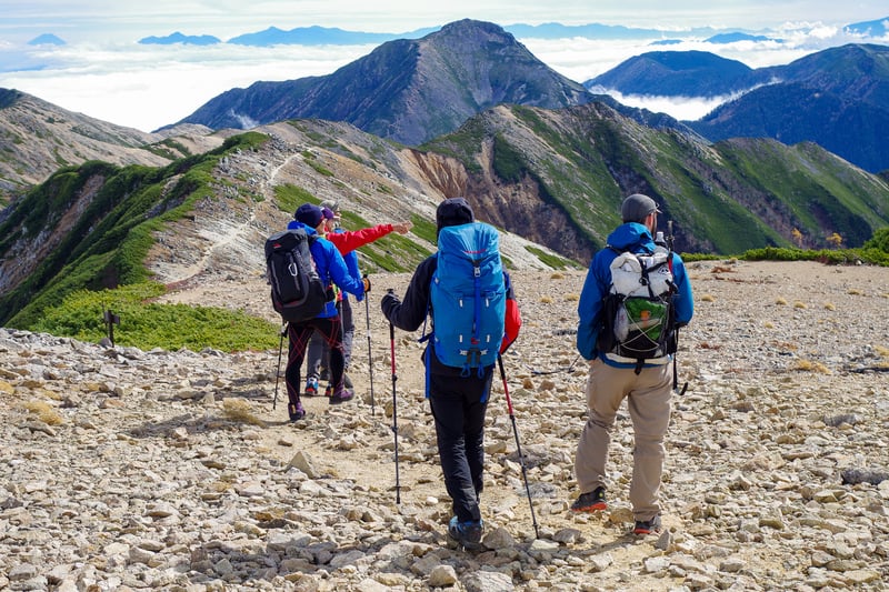
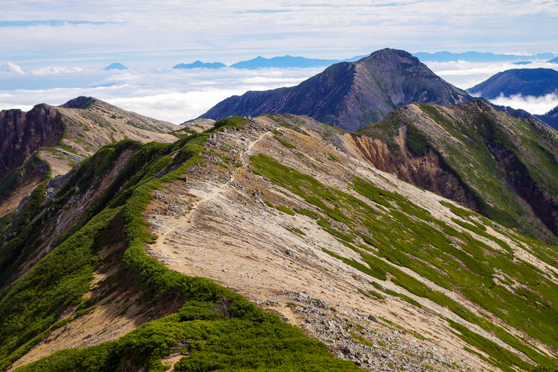
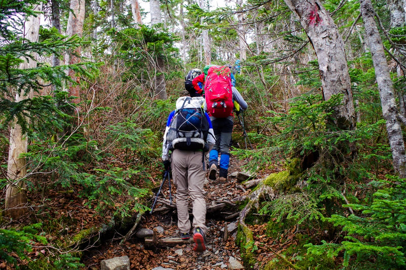
From here, the ridgeline dips and rises, sometimes quite suddenly, dropping below the tree line and soaring above it again. After about 3.5 hours of traversing, you’ll reach Mt. Chouyari, a small peak between Jonen and Mt. Chogatake. From there, it’s just 1.6 kilometers, or about 45 minutes, to the peak of Chogatake and the last mountain hut.
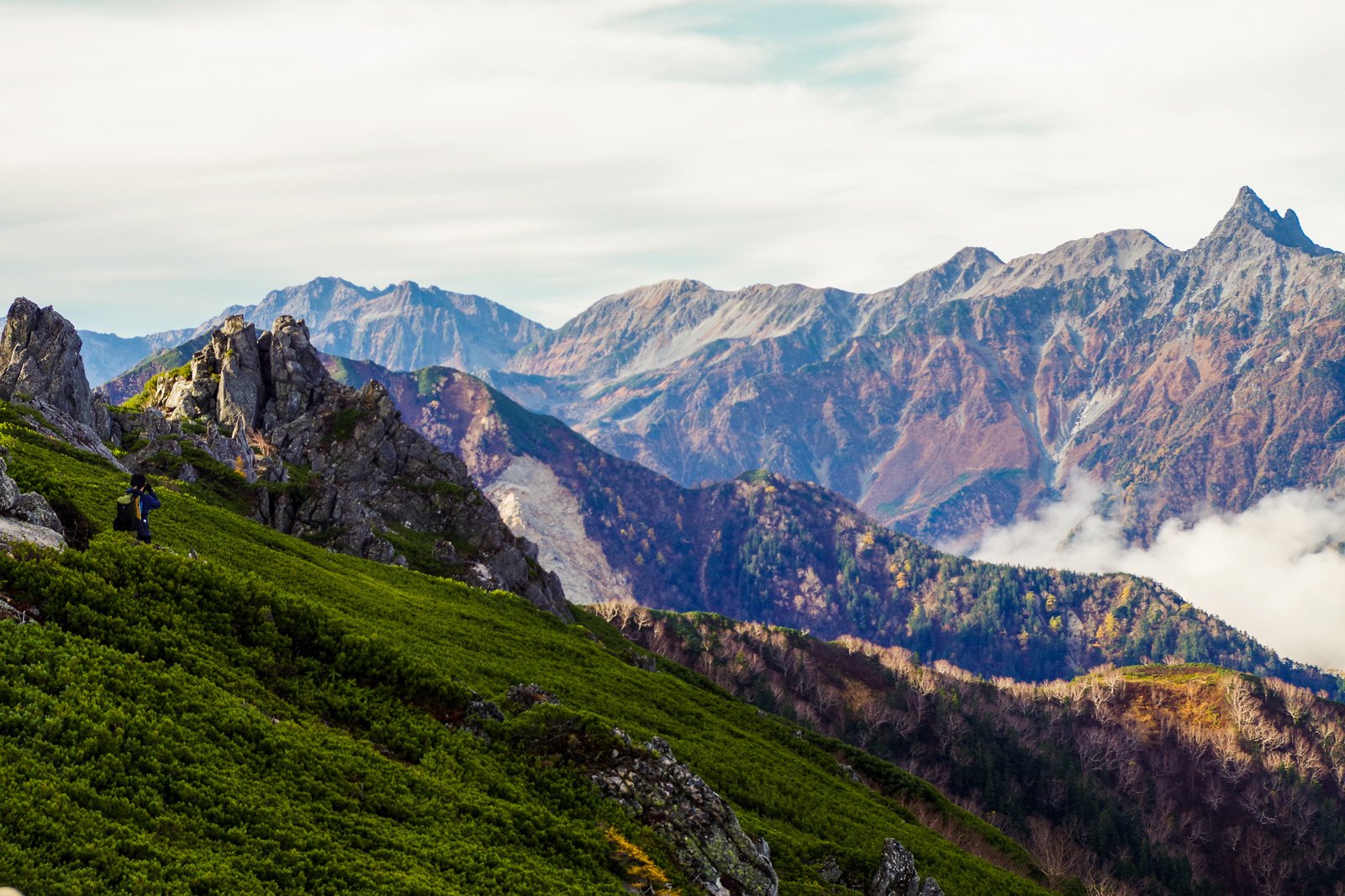
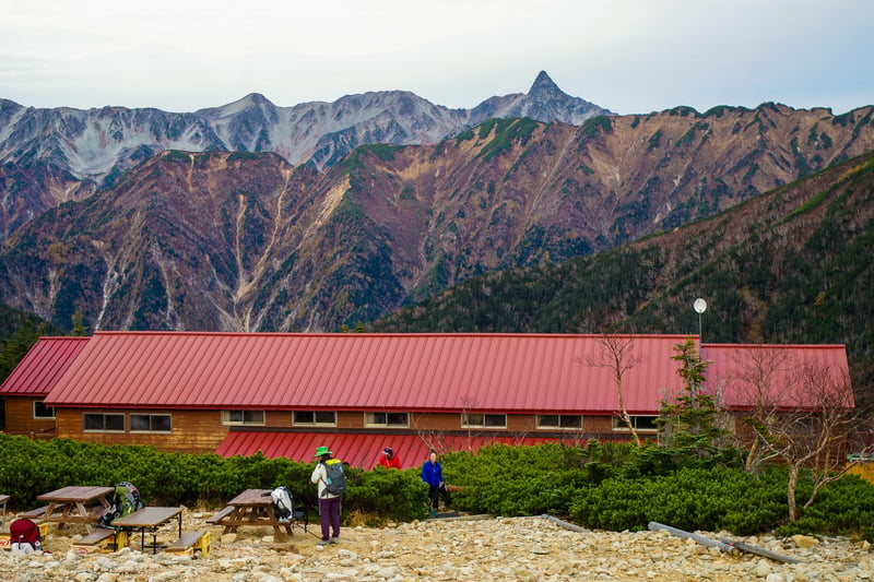
The ridgeline here is flat and expansive. On your right, you can see majestic views of the Alps, including the infamous Daikiretto Pass, and on your left, you can look over the Matsumoto valley, possibly covered in a dense sea of clouds. You’ll know you’ve arrived when you see the red roof of Chogatake Hutte in the distance. The peak is nearby—just a minute or two from the lodge.
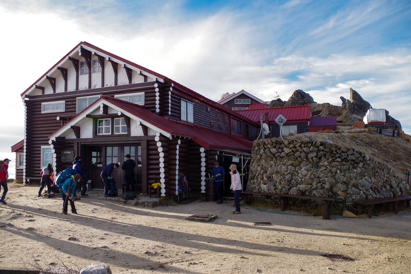
Chogatake Hutte
The Chogatake Hutte sits in the middle of the ridgeline, facing Mt. Yari and the Hotaka mountain range. It has a capacity of 200 and has space for around 30 tents.
This lodge’s specialty is its miso, made and fermented in-house from locally grown rice and soybeans. And while the lodge itself may not boast it, their coffee is pretty delicious too! A cup of either will warm you to the core.
Day 4: Mt. Chogatake to Mitsumata Trailhead
After three long days on the mountain, it’s finally time to descend back to civilization and take a long-awaited shower.
There are two main routes from the top of the mountain. You can either descend into Kamikochi or into Azumino. Neither route is particularly technical, but it’s important to be careful. Injuries are more likely to happen on the descent when you’re tired and distracted.
Both routes take about 3.5 hours to reach their respective trailheads, but from Kamikochi you have to walk an additional 2 hours to the bus terminal. From the Mitsumata trailhead in Azumino, you can take a taxi back to Hotaka Station or your car.
Access
The starting and ending trailheads are both located in Azumino City (next to Matsumoto), with an additional trailhead to Mt. Chogatake located in Kamikochi.
It is possible to park at the trailheads, but because the starting and ending points are different, it’s generally easier to take a taxi both to and from the trailhead.
Nakabusa Trailhead (Mt. Tsubakuro)
By Taxi from Hotaka Station: about 55 minutes, 8,940 yen*
Has space for 120 cars
Mitsumata Trailhead (Mt. Chogatake)
By Taxi from Hotaka Station: about 35 minutes, 6,240 yen*
Has space for 130 cars
Tokusawa Trailhead (Mt. Chogatake)
2 hours from the Kamikochi Bus Terminal on foot. See our Kamikochi page for access details.
*Taxi fares are 20% higher between the hours of 22:00 and 05:00.
Staying on the Mountain
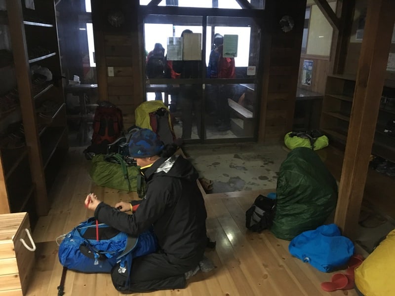
Mountaineering is a very popular activity in Japan and as a result, you’ll be able to find mountain lodges on most major trails. These lodges offer not only accommodation, but hot meals and clean water as well. They are a great resource, even for day trippers.
If you have never stayed at a mountain lodge before, there are a few things to keep in mind. One: lodge accommodations are similar to hostels, where you’ll sleep in a large room with other climbers. During weekends and holidays, the lodges may be very full. (Sometimes private rooms are available for groups.) And two: in order to protect the mountain’s natural environment and conserve water, there are no showers on the mountain. Things that we often take for granted, like toothpaste, can’t be used on the mountain either.
Despite lacking some of the creature comforts of home, they are overall pleasant places to relax and spend the night after a long day of climbing. See details for the major mountain lodges along the Panorama Ginza route below:
Mountain Huts
Enzanso (English)
Jonengoya (Japanese)
Daitenso Hut (English)
Chogatake Hutte (Japanese)
Conclusion
The Panorama Ginza Route is one of the most beautiful hikes in the Japanese Alps. As you walk along the ridgline of the mountains here, you’ll feel like the 3,000-meter peaks of Mt. Yari and Mt. Hotaka are close enough to touch. In the distance, Mt. Fuji floats ever on the horizon. This incredible scenery becomes an unforgettable memory of a once-in-a-lifetime experience.