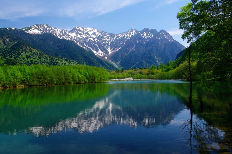
Enjoy some of Japan’s most stunning mountain scenery in Kamikochi.
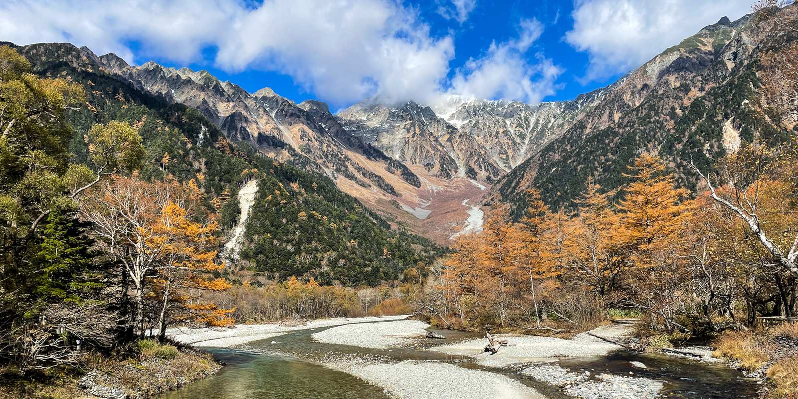
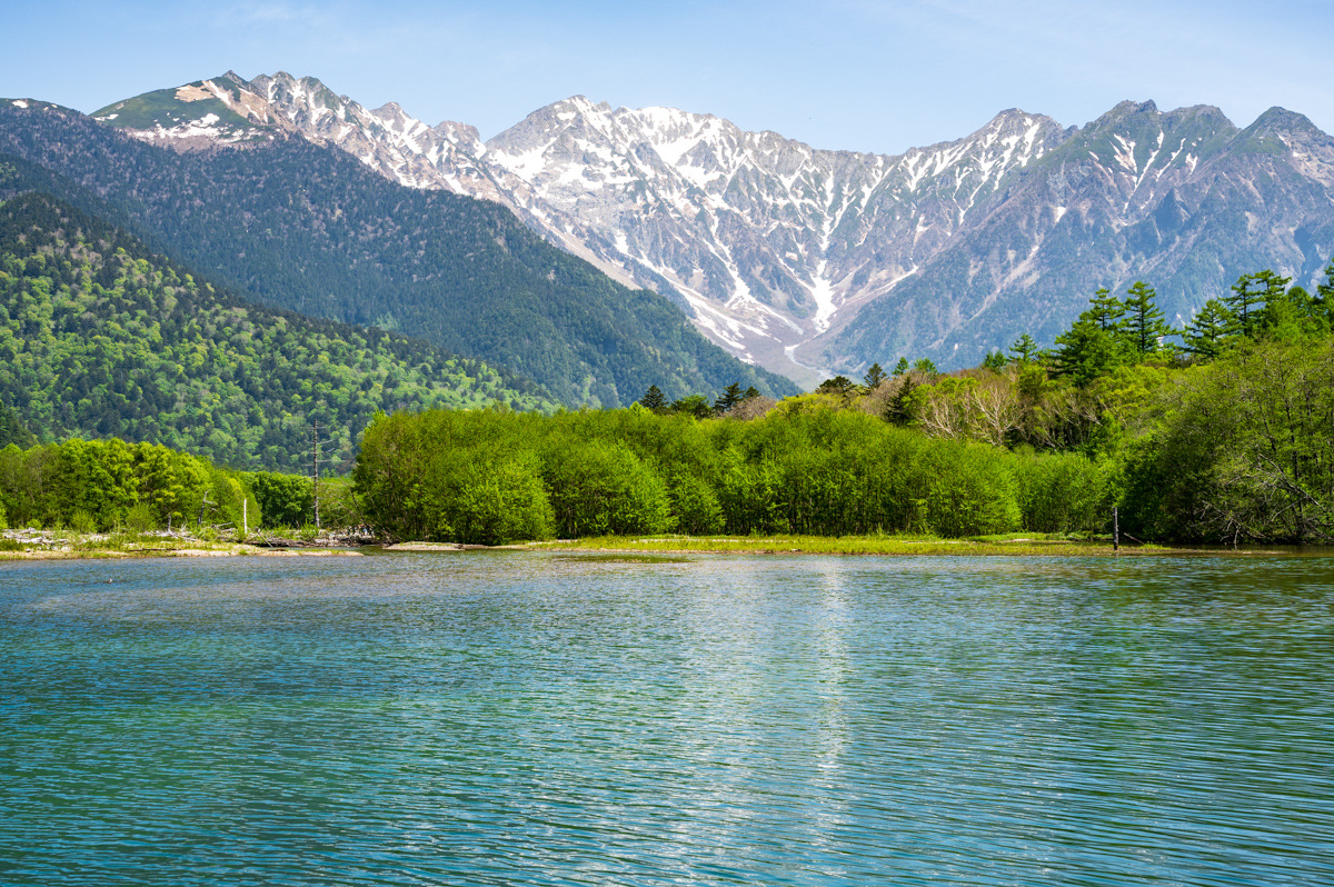
Surrounded by mountains towering over 3,000 meter heights, the emerald green forests and crystal clear rivers of Kamikochi remain largely untouched by man. The vivid colors of nature and the magnificent peaks of the Japanese Alps come together to form one of the most beautiful scenic locations in all of the country.
From Taisho Pond at the south of the basin all the way north to Tokusawa, Kamikochi stretches across six kilometers of marshland, river, and riparian forest. Relatively flat trails weave through the natural splendor of the basin, connecting Kamikochi’s many points of interest and mountain climbing trails.
Learn more about Kamikochi’s many trails, facilities and access below.
Kamikochi Travel Guide
Access to Kamikochi
Kamikochi sits in the center of Japan between the cities of Matsumoto in Nagano and Takayama in Gifu. It is accessible from both cities by a combination of train and bus. There are also direct buses to Kamikochi from Tokyo, Nagoya, Osaka and even Nagano city.
By Train/Bus
Tokyo to Kamikochi
Take the Shinjuku–Kamikochi line bus from Shinjuku Bus Terminal to Kamikochi (4hrs. 45min.). Or, take the Limited Express Azusa train from Shinjuku Station to Matsumoto Station (2hrs. 45min.), then take the Kamikochi line train to Shinshimashima Station (31 min.) and the Kamikochi line bus from Shinshimashima Station to Kamikochi (65 min.)
Nagoya to Kamikochi
Take the Nagoya–Kamikochi bus from Nagoya Meitetsu Bus Center to Kamikochi (6hrs).
Osaka/Kyoto to Kamikochi
Take the Osaka/Kyoto–Kamikochi line bus from Hankyu Sanbangai (Osaka) or Kyoto Station to Kamikochi (5hrs 40min to 6hrs 40min.)
By Car
Private vehicles cannot enter Kamikochi directly, so you'll have to park at the Sawando Parking Area (See in Google Maps) and take a bus from there. It's a 45-minute drive from the Matsumoto IC exit of the Nagano Expressway to the parking lot, and then about 35 minutes by bus to Kamikochi. See the Sawando-Kamikochi line bus timetable here.
Things to Do in Kamikochi
Hiking
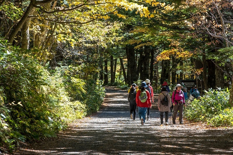
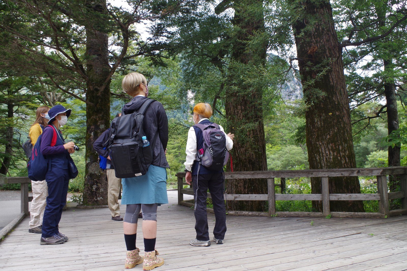
Stretching from Taisho Pond at the entrance of the valley to the Yoko’o Bridge at the other end of the valley, nearly 11.5 kilometers of hiking trail follows the Azusa River and weaves through sections of virgin forest. As you walk from scenic point to point, you may find delicate alpine flora or come upon some of the valley’s wild inhabitants.
Mountain Climbing
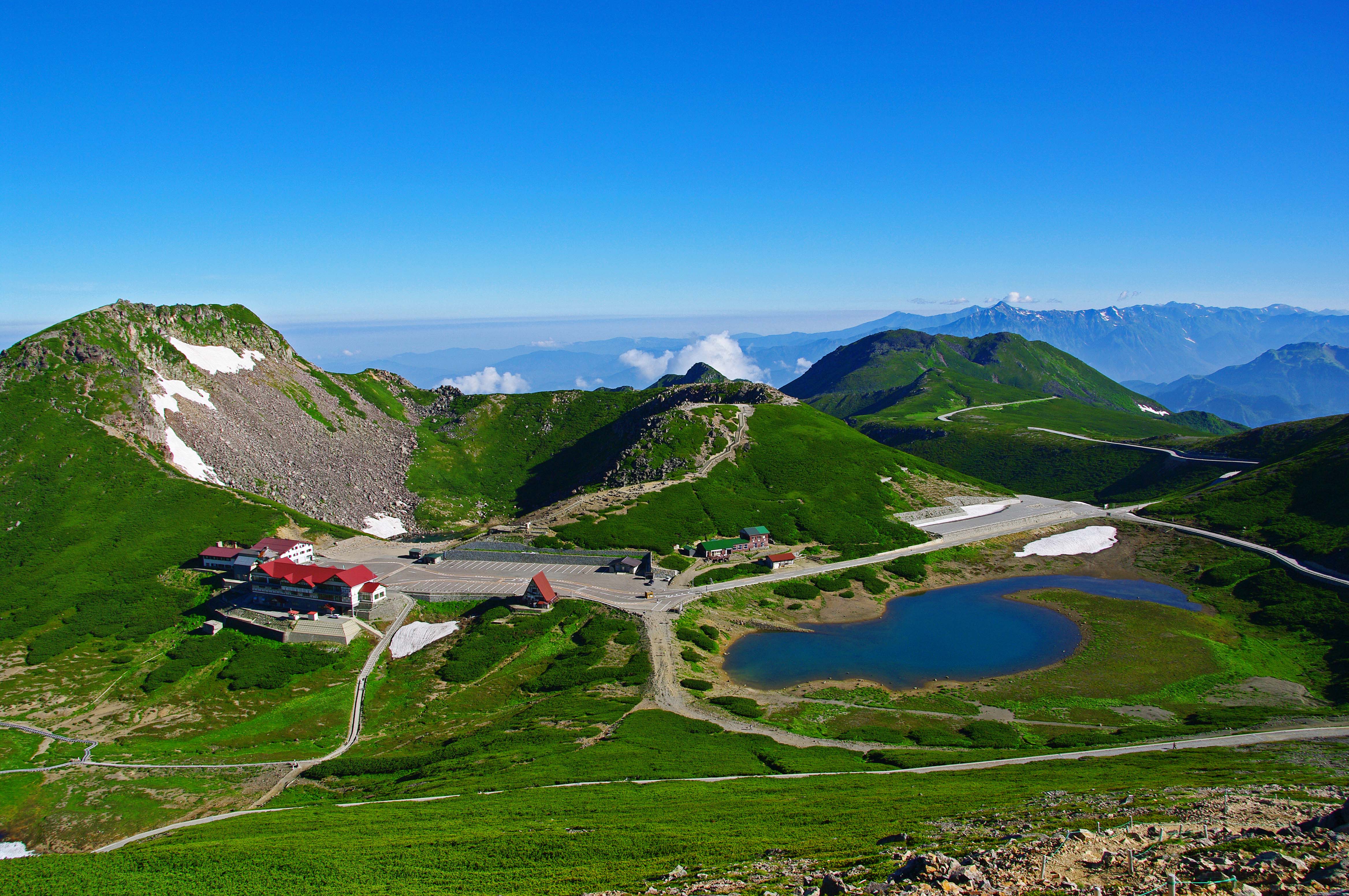
Many popular mountain climbing trails start from Kamikochi and ascend to peaks ranging in altitude from 2,000 to 3,000 meters. Some trails can be accomplished in a single day (Mt. Yake) while others require two to three days to complete (Mt. Yari or Mt. Okuhotaka). See here for more information about mountain climbing routes in the Japanese Alps.
Forest-bathing
Take in the sounds of rustling leaves, flowing water and singing birds as you walk through virgin forests and cool marshes. Even in summer, Kamikochi remains much cooler than the city, with an average temperature of 23°C in July, making it a great place to escape the heat and enjoy nature.
Camping
Several campgrounds are located in the valley, including Konashidaira Campground near the Kappa Bridge, Tokusawa Campground in the middle of the valley and Yoko’o Campground at the end of the valley. Konashidaira Campground and Tokusawa Campground even offer rental tents with everything you need to get a good night's sleep.
Luxuriate in Nature
Surrounded by the mountains of the Japanese Alps is an oasis of cafes, restaurants and hotels. Enjoy majestic scenery and fresh air from the comfort of one of Kamikochi’s hotels. Several have hot springs or public baths where you can take in the scenery of Kamikochi while soaking in rejuvenating waters.
Recommended Courses in Kamikochi
You could spend multiple days covering the trails and mountain climbing routes around Kamikochi, but you can see most of the basin’s beauty in just a day. Some will even be satisfied with the views from the Kappa Bridge alone. These are our most recommended courses in Kamikochi:
The Half-day Kamikochi Course
Time: 3 hours 30 minutes
Route: Taisho Pond —Walk 75 min./3.7 km→ Kappa Bridge —Walk 6 min./0.3 km→ Kamikochi Bus Terminal
The scenery of Mt. Okuhotaka reflecting in Taisho Pond and towering in front of the Kappa Bridge is quintessential Kamikochi. To enjoy both, get off the bus at Taisho Pond bus stop at the entrance to the park. The shoreline is just a few minutes on foot from the bus stop.
After enjoying the views of Mt. Okuhotaka and Mt. Yake, take the trail heading towards the Kappa Bridge. The trail takes about 75 minutes, and along the way, you’ll pass through Tashiro Marsh and have opportunities to visit Tashiro Pond and the Weston Monument.
Once you arrive at the Kappa Bridge, take in the park’s most iconic view and stop for lunch at one of the area’s restaurants or cafes. The Kamikochi Bus Terminal is about 10 minutes on foot from the Kappa Bridge.
The Full-day Kamikochi Course
Time: 6 hours
Route: Taisho Pond —Walk 75 min./3.7 km→ Kappa Bridge —Walk 60 min./3 km→ Myojin Pond —Walk 60 min./3 km→ Kappa Bridge —Walk 6 min./0.3 km→ Kamikochi Bus Terminal
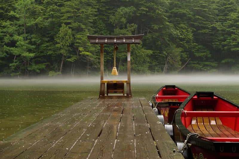
Building on our first route, we add another one of Kamikochi’s must-see spots: Myojin Pond. Kamikochi’s name translates roughly to “the ground upon which God landed,” and Myojin Pond is considered to be the very spot where the deity of the Hotaka Shrine first touched ground. From the Kappa Bridge, Myojin Pond is a 60-minute walk. If traveling on the lefthand side of the Azusa River, you'll pass by Dakesawa Marsh on the way. At the entrance to the pond is a large torii gate and the Kamonjigoya Lodge.
At Myojin Pond, walk to the end of the dock, make a wish at the small shrine and take in the tranquil scenery. A small trail follows the shoreline, allowing you to take in the pond from a variety of perspectives.
Finally, return towards the Kamikochi Bus Terminal using the trail on the opposite side of the river.
When to Visit Kamikochi
Kamikochi is open annually between mid-April and mid-November. During winter, no buses run to the park and all facilities are closed.
The Seasons of Kamikochi
At the beginning of the opening season in spring (mid-April to May), you can enjoy the yellowish green of new leaves on the trees and the mountains of the Japanese Alps still covered in snow. From June to July, enjoy summer scenery of vibrant greenery, crystal clear waters and blue mountains. Autumn colors take hold from late September, completely covering the valley before Kamikochi closes for the season in mid-November
Peak and Off-Peak Season in Kamikochi
Peak season includes the summer period from mid-July to mid-August and the fall foliage season from late September to late October. The park can be very busy during these times, so if you’d like to avoid the crowds, consider visiting during the rainy season (June to early July) or late autumn (early November).
Nearby Sightseeing Spots
In addition to Kamikochi, there are many other places to see around the Japanese Alps. If you can’t get enough of the outdoors, consider a visit to the highlands of Norikura Kogen. At the base of Mt. Norikura (3,026 m), you can go hiking or mountain biking during summer and enjoy skiing, snowshoeing, or ice climbing during the winter. Nearby is also a famous hot spring area, Shirahone Onsen, which is known for its milk-white mineral water. Both are accessible by bus from Shinshimashima Station.
Over the border in Gifu, you can also visit the World Heritage site of Shirakawa-go and stay in the quiet mountain town of Takayama. See an example itinerary visiting Kamikochi, Takayama and Shirakawa-go here.
Accommodations in Kamikochi
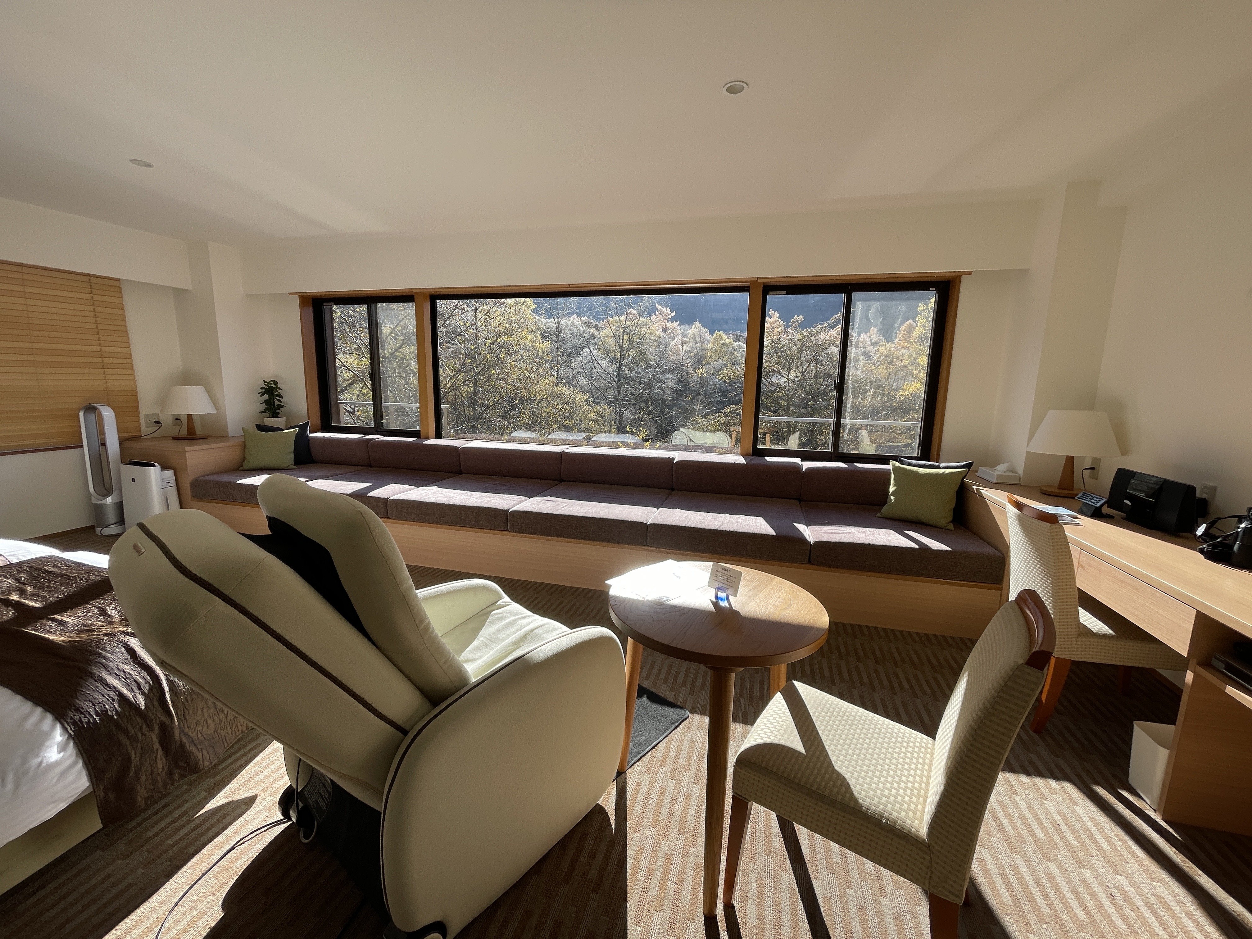
If you plan to stay in Kamikochi, you can choose from a range of accommodation options that suits your travel plans, from luxurious hotels to mountain lodges and campgrounds. Most hotels are located around the Kappa Bridge.
From Myojin Pond and further onward, you’ll find numerous mountain lodges, such as the Kamonjigoya lodge, whose history goes back nearly 150 years. These accommodations are barebones in comparison to the hotels, but they are perfect for mountain climbers or hikers just looking for a place to sleep for the night.
The Konashidaira Campground (Japanese website here), Tokusawa Campground and Yoko'o Campground allow you to sleep under the stars. The former two both have tent rental options, so you don’t have to bring your own equipment. Yoko’o Campground, however, does not.
Several hot springs areas are located outside of the park proper, such as Nakanoyu Onsen at the entrance of the Kama Tunnel, Hirayu Onsen and Shirahone Onsen about 45 minutes from Kamikochi by bus (changing at Sawando Bus Terminal). While outside of the park, they are good places to stay if you’re looking for traditional Japanese ryokan inns.