Does the thrill of climbing an active volcano appeal to you? Nagano has not one, not two, but three mountains in various states of high volcanic activity that you can climb.
Climbing Nagano's Volcanic Peaks
This article was updated on November 16th, 2023.
Climb Mt. Asama
The 2,568-meter-tall Mt. Asama towers over Eastern Nagano, and is easily visible from its namesake Asama train on the Hokuriku Shinkansen Line.
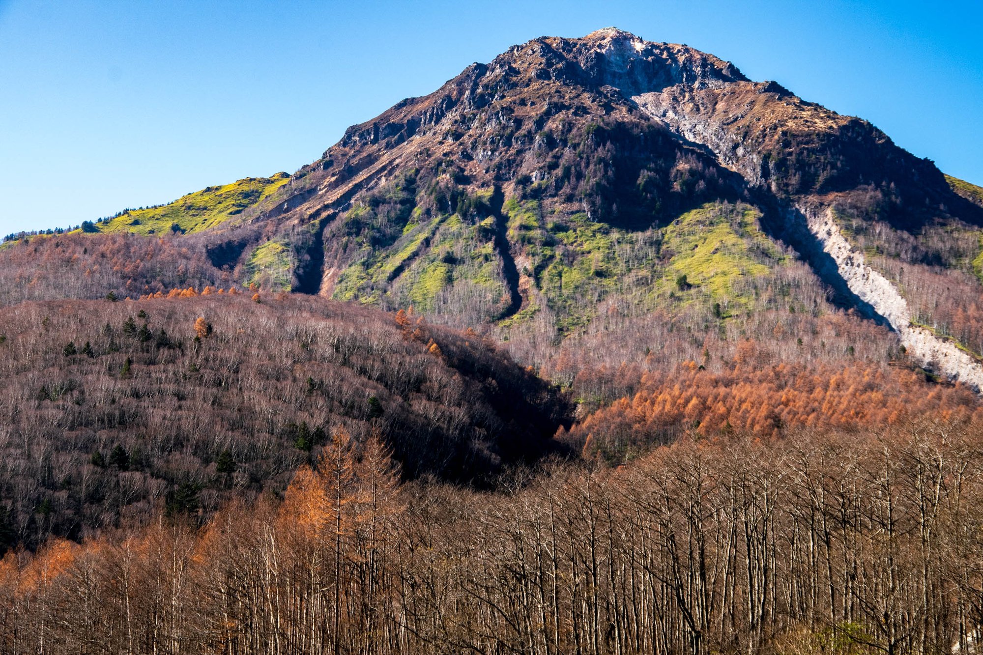
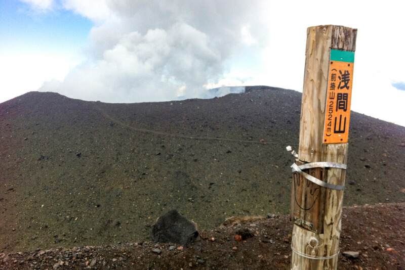
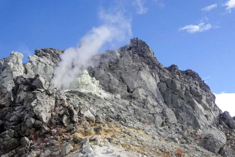
In addition to the current crater of Mt. Asama, remnants of two previous craters can be seen: one is Mt. Maekake (2,524 m), the crater formed around 900 years ago; and the other is Mt. Kurofu (2,404 m), the original which collapsed over 25,000 years ago.
The current crater is off-limits due to volcanic activity, so the closest one can climb to is Mt. Maekake. Mt. Kurofu is farther from the peak, but as a result offers some of the best views of Mt. Asama. The two of the most common trails are: 1) Asama Sanso/Tengu Onsen (1,410 m) to Mt. Maekake and 2) Kurumazaka Pass (1,973m) to Mt. Kurofu. The former takes about 7 hours roundtrip while the latter is about 3.5 hours.
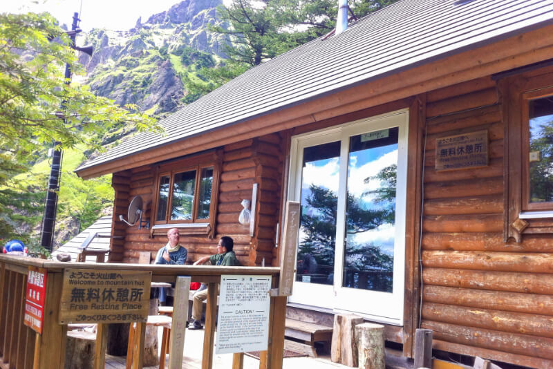
The Kazankan emergency shelter, about 4 kilometers from the Asama Sanso / Tengu Onsen trailhead
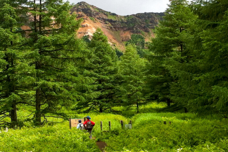
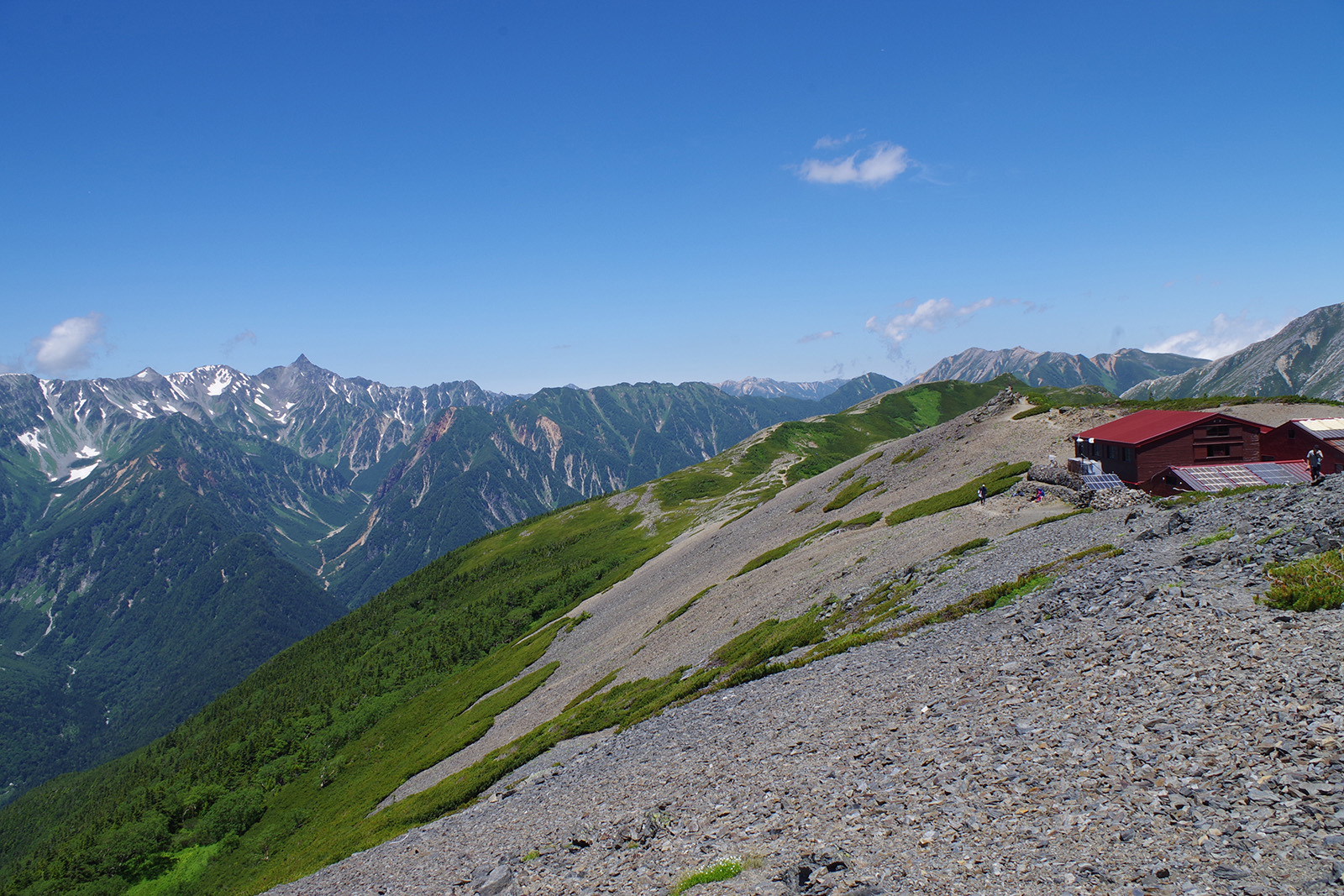
Crossing the meadow
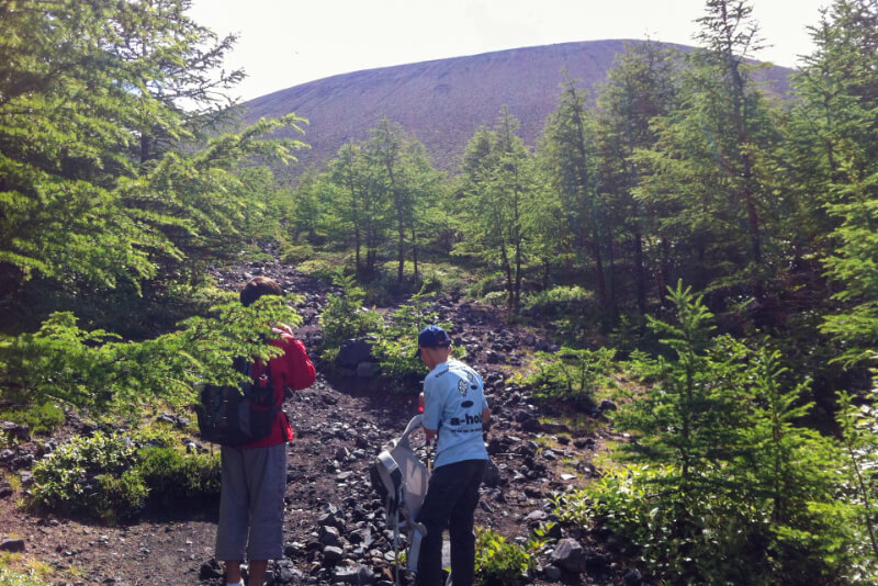
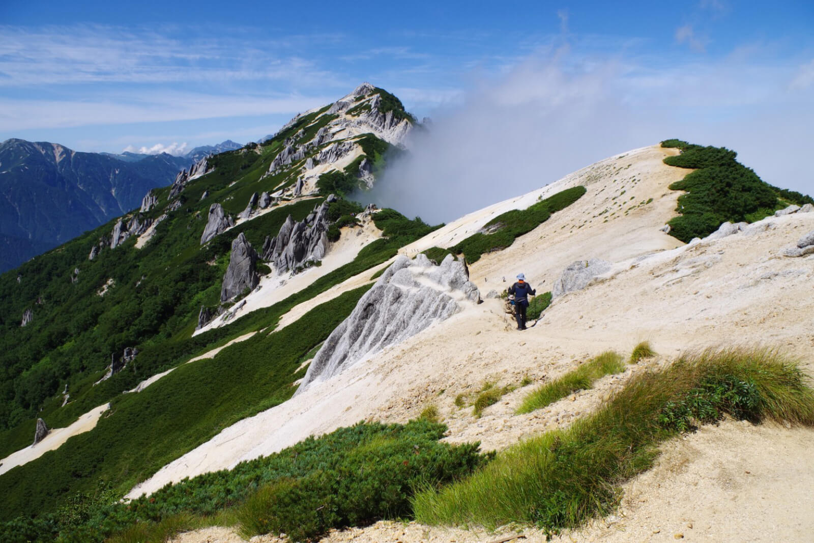
Approaching the ascent to the crater
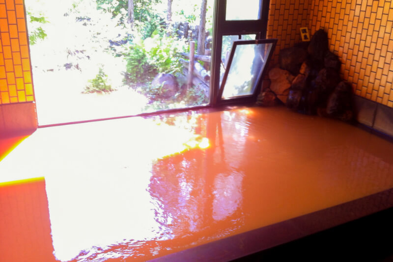
The iron-rich mineral hot springs of Tengu Onsen make for a great end to a hike
Before going, be sure to check the current Volcanic Activity level with Japan’s Meteorological Agency’s website . Level 1 allows access to Mt. Maekake, Level 2 to within 2km of the summit meaning Sainokawara. Level 3 would mean a 4-km exclusion zone so only to the 1st torii gate from the Asama Sanso trailhead, while the trail from Kurumazaka Pass would be closed entirely.
Access
Both the Asama Sanso/Tengu Onsen and Kurumazaka Pass trailhead to Mt. Asama are reachable by car via the ‘Cherry Park Line’ (Komoro City Rte. 106). For public transport, JR runs two buses per day from Sakudaira Station through central Komoro City stopping at ‘Asamayama Tozanguchi’ which is 4km from Asama Sanso, and Takamine Kogen Hotel at Kurumazaka Pass (bus information in Japanese).
Climb Mt. Yake

The only active volcano in Japan’s Northern Alps, 2,455-meter-tall Mt. Yakedake is one of the most popular day-trip climbs from Kamikochi. Intrepid mountain climbers are treated to a view of the white volcanic steam rising from multiple fissures around the crater. The three-hour climb to the summit of Yakedake is a "must-do" hike for many mountaineers in Japan.
There are two main approaches from the summit: 1) from Nakanoyu Onsen and 2) from Kamikochi.
Known as the gateway of the Northern Japanese Alps, Kamikochi is a picturesque valley situated at 1,500-meter elevation along the banks of the turquoise blue Azusa River with the 3,000-meter peaks of the Hotaka Range towering overhead. From the main bus terminal, the trail to Yakedake crosses Kamikochi's iconic Kappa Bridge, named after the water sprites that supposedly inhabit the river. The bridge affords an iconic view up the river valley to the massive Hotaka Mountains. The course follows the river bank to the Weston Relief, a memorial to the missionary from Britain known as the Father of Mountaineering in Japan.
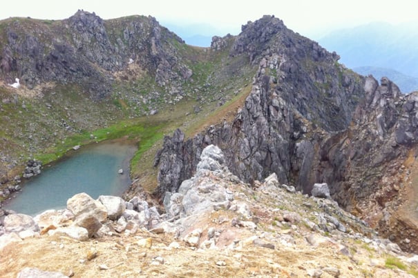
Past Tashiro Bridge, the path starts a steep ascent over rugged terrain with vertigo-inducing fixed ropes and steel ladders, eventually reaching the rocky summit for a rewarding panoramic view as well as a peak into the steaming caldera with its picturesque lake.
Access
By Car
The Nakanoyu Onsen trailhead is about 70 minutes from the Matsumoto Exit of the Nagano Expressway. There is a parking for about 15 cars by the trailhead (see in Google Maps here).
The Kamikochi trailhead isn’t directly accessible by car, so park at the Sawando Parking Lot and change to the Kamikochi shuttle bus from there.
By Bus
Both trailheads are accessible using the Kamikochi shuttle bus from Shinshimashima Station, the Sawando Parking Lot or Hirayu Onsen. The Nakanoyu Onsen trailhead is about 75 minutes on foot from the Nakanoyu bus stop. The Kamikochi trailhead is about 15 minutes on foot from the Kappa Bridge.
Climb Mt. Ontake
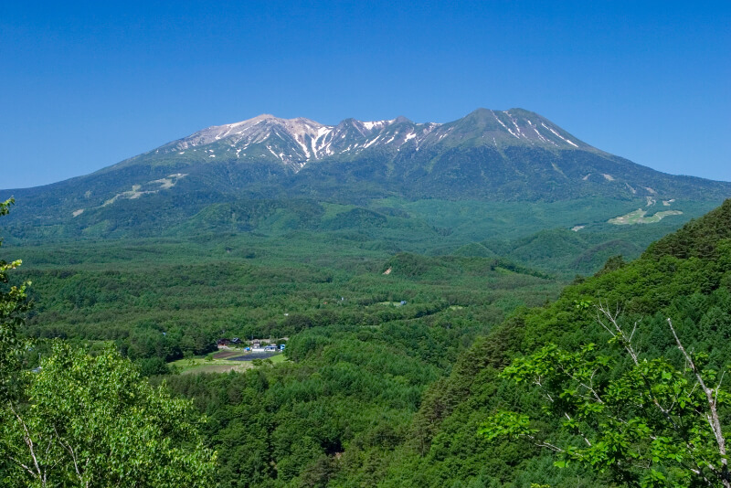
At 3,063 meters high, Mt. Ontake is Japan’s 2nd tallest volcano and is also considered one of Japan’s holiest mountains. Mountain ascetics have traveled here for centuries to climb the mountain and seek enlightenment. The shrines and stone monuments dotting the mountainside are a testament to its spiritual history.
Mt. Ontake had one of the deadliest eruptions in recent history in September of 2014, killing 58 people and leaving 5 missing. Its volcanic activity has since settled and it currently rests at Volcanic Alert Level 1. 9 years after the eruption, the trail to Kengamine, Mt. Ontake’s highest peak, has finally been lifted as of July 1st, 2023.
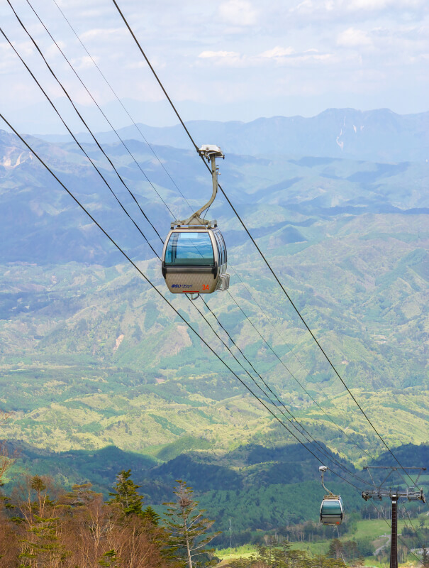
The most popular route is via the Ontake Ropeway (accessible by bus from Kiso-Fukushima Station) which will carry you all the way to an elevation of 2,150 meters. The remaining 900 meters in altitude to the top can be ascended via a 4-km long course taking approx. 6 hours roundtrip.
Access
From Kiso-Fukushima Station, the Ontake Ropeway Line bus runs to Ontake Ropeway (60 min.). However, buses are limited, so we recommend traveling by car.
Stay Safe when Climbing Nagano’s Volcanos
Volcanos are an awe-inspiring natural force and seeing one up close can be an incredible experience. However, climbing volcanos comes with inherent risk. Take precautions when planning a volcano climb, such as:
1. Checking the current volcanic alert level
Volcanic activity is regularly monitored and updated on the JMA website (see volcanic alerts here). If a volcano reaches a certain level of activity, the alert level for that area will be raised and parts of the mountain may be closed to the general public. Regularly check the volcanic alert level of the volcano you plan to climb and be prepared to change plans if necessary.
2. Bringing appropriate gear
Even if there hasn’t been any recent volcanic activity, a volcano could erupt at any moment. We recommend bringing the following equipment in addition to your regular hiking gear: a hard hat, dust mask and dust goggles.
3. Creating and submitting a trekking itinerary
Creating a trekking itinerary is a great way to prepare for your climb and share your plan with your loved ones. If an accident occurs during your climb, search and rescue will be better prepared to find you. See here for more information on submitting a trekking itinerary.
4.Refrain from entering off-limit areas
Regardless of the volcanic alert level, refrain from entering roped-off areas. Areas are always roped off for a reason. Some volcanic gases can negatively affect climbers, causing dizziness, loss of consciousness or asphyxiation.
Conclusion
All three of these volcanoes are only moderately difficult to climb, and don’t require any technical experience during the climbing season. Proper footwear and ample water and food are necessary, and mountain weather is liable to change quickly so be prepared accordingly. But with the right effort and preparation, you too can climb one of Nagano’s active volcanoes.