The Nakasendo was one of five major roads, known as Gokaido, connecting Japan during the Edo Period (1603-1868). Nakasendo, meaning "inner mountain road," ran through the center of Japan's mountainous island of Honshu, linking the imperial capital of Kyoto to the Tokugawa Shogun's capital in Edo (now Tokyo). In its day, it was an important thoroughfare utilized by Daimyo lords, peasants, traders and religious pilgrims.
Of the Nakasendo's 69 post-towns, 26 are located in Nagano Prefecture and some look nearly the same as they did during their hey-day. Traveling on the Nakasendo is a great way to experience Japanese history up close, observe Edo Period architecture and feel what it was like to be a traveler in Japan during that time. Many sections of the Nakasendo are also located in beautiful areas of the Japanese countryside in quaint villages or serene natural settings. Whether a day hike or a multi-day excursion, the Nakasendo has options for any traveler.
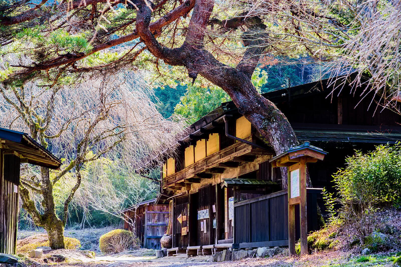
Trails in the Kiso Valley
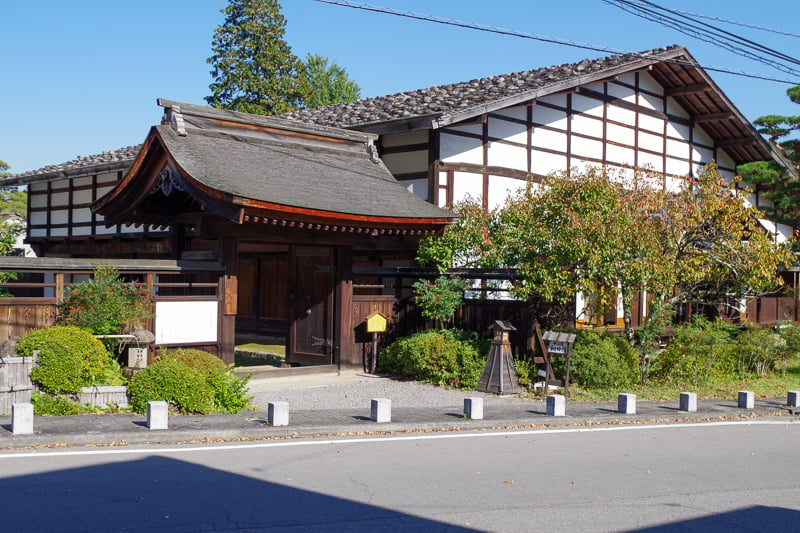
Stroll through the Town of Narai
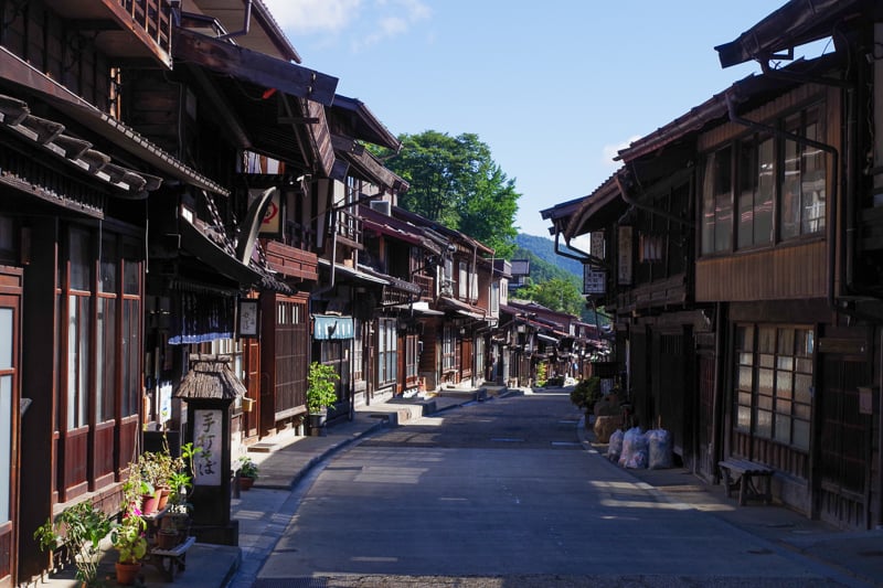
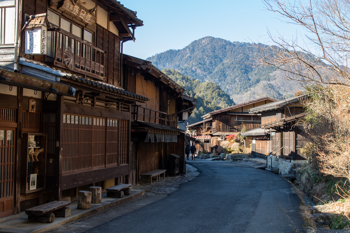
For an easy walk or a day trip to the Kiso Valley, Narai post-town (often written Narai-juku) is a great option. The longest preserved post-town on the Nakasendo, Narai prospered as the halfway point between Edo and Kyoto. There are still many temples, shrines, art galleries and restaurants to enjoy.
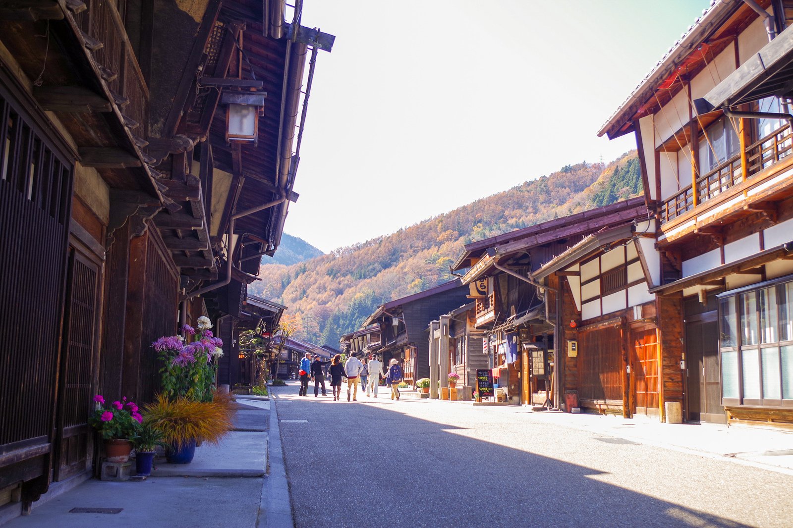
The Magome—Tsumago Trail
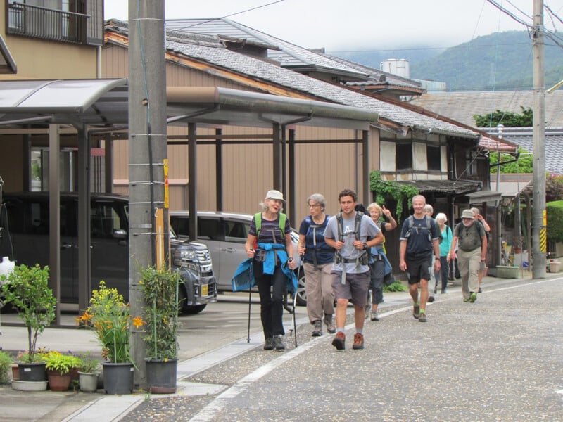
Likely the most iconic walk of the entire Nakasendo, the trail from Magome to Tsumago is excellent for a full day in the Kiso Valley. There is a little bit of everything on this train including two post-towns with very different atmospheres, steep mountains, sleepy villages, picturesque rice paddies and raging waterfalls.
Many people prefer to start from Magome and finish in Tsumago as the former is higher altitude, meaning less uphill walking overall. The trail crosses Magome Pass (790 m) before descending into the Kiso Valley and Tsumago. It’s about 9 kilometers in length and takes 2.5 to 3 hours to complete, including a stop for tea at the Ichikokutochi Tateba Chaya resthouse.
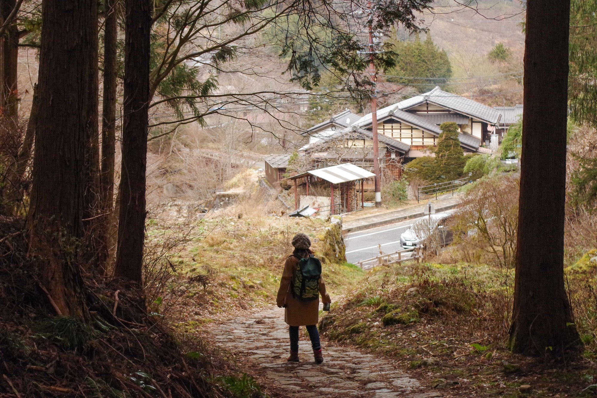
The Yabuhara—Narai Trail (Torii Pass)
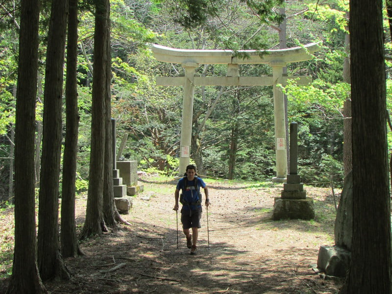
The section between the neighboring post-towns of Yabuhara and Narai is a great option if you have a little more time to explore. The trail climbs through the forest and up to Torii Pass at 1,197 meters high before descending back down into the valley. On the way, you can visit the remains of Yabuhara Shrine with views of the sacred volcano Mt. Ontake on clear days.
We recommend starting from Yabuhara Station and finishing at Narai. It is about 6 kilometers in length and takes around 3 to 3.5 hours to complete. See a detailed account of the trail here.
The Nagiso—Nojiri Trail
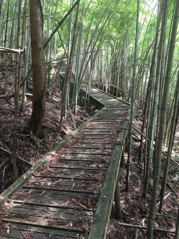
This section of the Nakasendo is actually a detour used when the main trail was damaged by floods and is called "Yogawamichi." It connects Midono and Nojiiri post-towns and is longer and less traveled than the other trails of the Nakasendo—but great if you’re looking for a new section to conquer. From Nagiso Station, follow the signs for the Nakasendo towards Nenoue Pass and Nojiri Station. The signs are relatively frequent and well-marked.
The walk is around 16 kilometers long and takes 4 to 5 hours to complete. It is a mixture of trail and pavement and passes by small stone statues, wayward shrines and temples. A highlight of the trail is the boardwalk through a forest of bamboo.
Near Nojiri Station, visit cafe Donguri while waiting for the train. Make sure to check the train schedule beforehand as trains are infrequent.
Trails Beyond the Kiso Valley
The Karuizawa—Sakamoto Trail (Usui Pass)
Sitting between the post-towns of Karuizawa in Nagano and Sakamoto in Gunma, Usui Pass (956 m) was one of the last major hurdles for travelers on their way to Edo. While paved roads now make it easy to reach the pass by car, part of the old Nakasendo still remains here.
The course connects Karuizawa Station (Hokuriku Shinkansen line) and Yokokawa Station (Shinetsu Main line) for a total distance of 17 kilometers. You can also take a bus or taxi from Karuizawa Station to the Usui Pass Observation Platform for a somewhat easier 12-kilometer hike. See more information about the Karuizawa—Sakamato Trail here.
The views of Mt. Myogi and its surroundings from the top of the pass are stunning on a clear day, and farther along the road is Kumano Shrine, a rare example of a shrine that sits on a prefectural border.
Please note: There is no public transportation access directly back to Karuizawa Station. From Yokokawa Station, take the Shinetsu Line to Takasaki Station, then the Hokuriku Shinkansen back to Karuizawa or Tokyo.
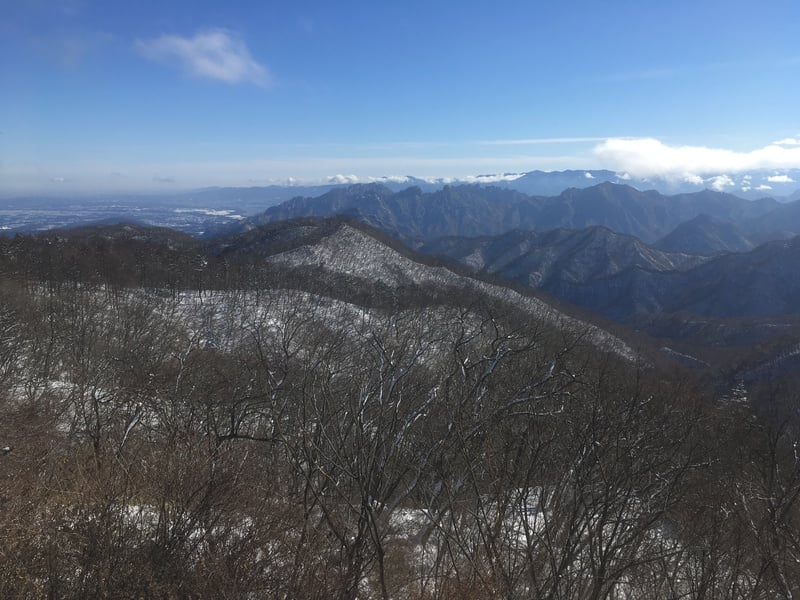
The Shimosuwa–Wada Trail (Wada Pass)
The section between the post towns of Wada and Shimosuwa was the longest of any along the Nakasendo at 22.6 kilometers and crossed the highest point of the Nakasendo at Wada Pass (1,531 m), making it the most difficult stretch of the entire trail.
About two-thirds of this section now follows paved roads, leaving about 8 kilometers of forested trail around the climb up Wada Pass. Public transportation is scarce here, so those who aren’t willing to walk the entire length on foot would need to arrange drop-off and pick-up by taxi. See more about the trail here.
Not much remains of Wada’s post-town, but the main Honjin inn has been restored and now operates as a museum. Shimosuwa has also changed much since its post-town days, but it offers sightseeing in the form of the Akimiya and Harumiya shrines of Suwa Taisha.
Sekigahara
Located on the Nakasendo in Gifu Prefecture, Sekigahara was the site of one of the most important battles in Japanese history that saw the Tokugawa Shogunate rise to power. An easy day trip from Kyoto, Sekigahara has a history museum and various walks around the battlefield. Most of the walks are paved with little vertical changes.
The trail between Sekigahara and Tarui post-towns is 5.2 kilometers long and takes about 2 to 2.5 hours to complete.