Surrounded by the mountainous Japanese Alps, Nagano Prefecture is enjoyed best by car. It just so happens that Nagano has one of Japan's best driving courses, known as the Venus Line. A drive along the Venus Line offers new vistas every season and has many sightseeing spots along the way.
The Venus Line: One of the Best Driving Courses in Japan
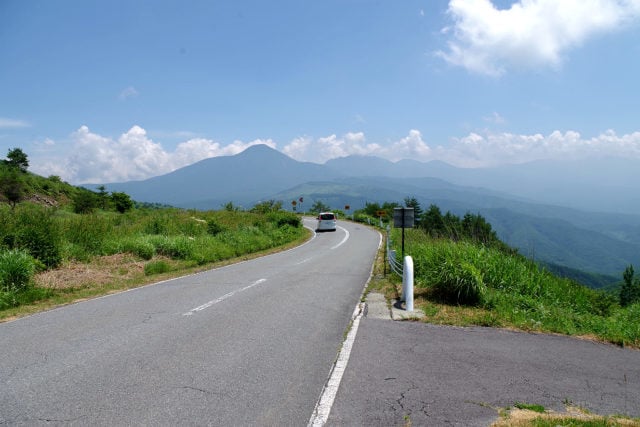
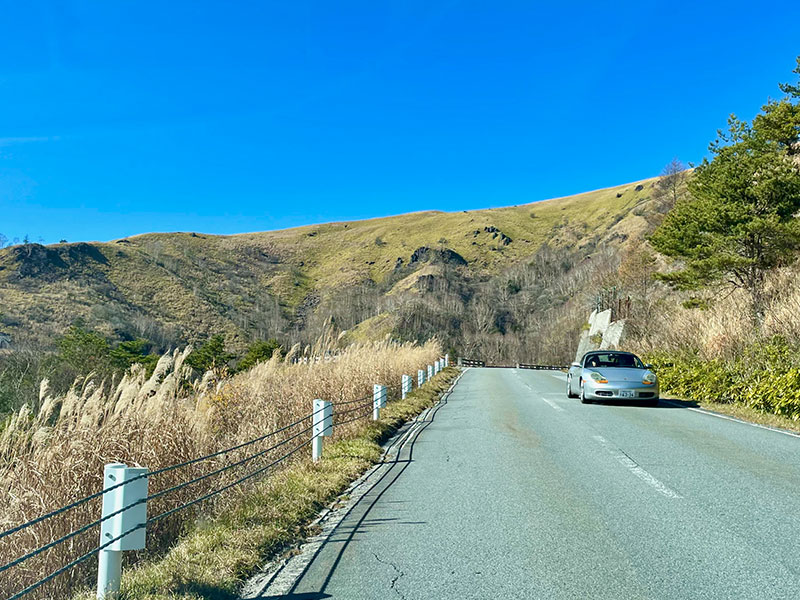
The Venus Line is a 76-kilometer road connecting Chino City in the Suwa Region of Nagano with the Utsukushigahara Open-Air Museum of Art in Ueda City (Eastern Nagano). The road has been open to the public free of charge since 2002, and its lovely moniker, "Venus Line," comes from the goddess-like appearance of Mt. Tateshina that can be seen along the way. Fantastic lakes, a gorgeous wetland, and beautiful mountains surround the area, with a spectacular view of Mount Fuji beyond. The lack of traffic signals and unparalleled vistas make this one of Japan's most outstanding driving courses.
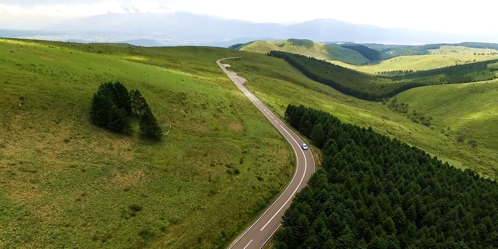
Every season on the Venus Line offers something new, giving you a reason to visit again at different times of the year. The pictures in the article are taken in late fall, when the highlands are covered in brightly shining fields of Japanese Silver Grass.
Visiting the Venus Line in Fall
The Venus Line starts once you get off at the Suwa IC of the Chuo Expressway. Driving along Route 152 through the city of Chino brings you to the starting point of the Venus Line in about 10 minutes.
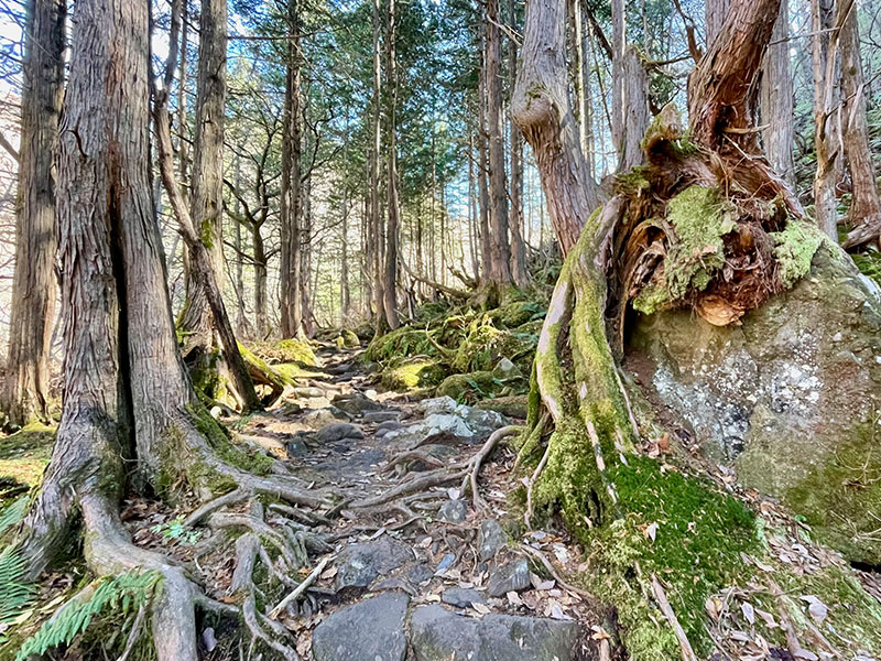
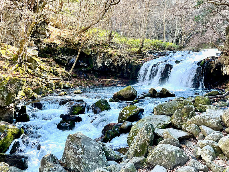
Tateshina Otaki Falls
The first stop is Tateshina Otaki Falls. After parking, walk along the promenade through a moss-covered virgin forest. After about 10 minutes, you'll reach the waterfall. It is not large, but the gentle flow of the falls is mesmerizing. There is also a short boardwalk where you can take pictures of Japanese forest scenery.
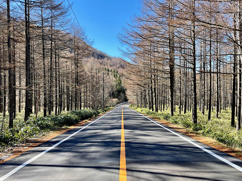
After leaving Tateshina Otaki, it is time to head to the Shirakaba area. Driving through the trees under the pleasantly sunny sky, you’ll reach Lake Shirakaba in about 25 minutes.
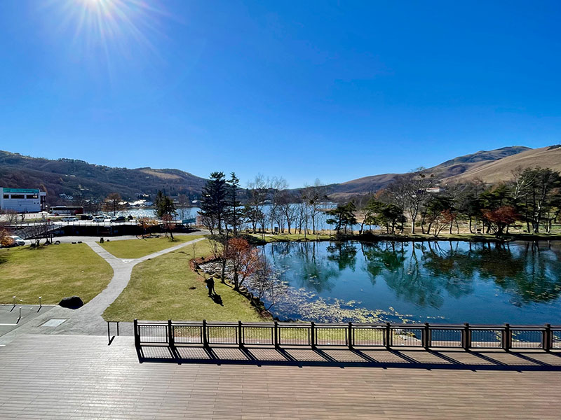
Lake Shirakaba
Lake Shirakaba is a plateau lake located at the foot of Mount Tateshina. The circumference of the lake is about four kilometers. The lakeside area has a resort complex with an amusement park and a mini-golf course centered around the Ikenotaira Hotel. During winter, numerous ski resorts operate on the hillsides surrounding the lake.
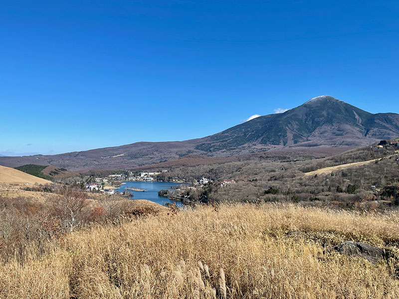
From Lake Shirakaba, head up to one of the most delightful driving sections of the Venus Line. After a while, you will come to a large parking lot. Park your car and enjoy the view of Lake Shirakaba again, and beside it, you can see beautiful Mount Tateshina, also known as the Fuji of Suwa. Next, you'll move on to Kirigamine.
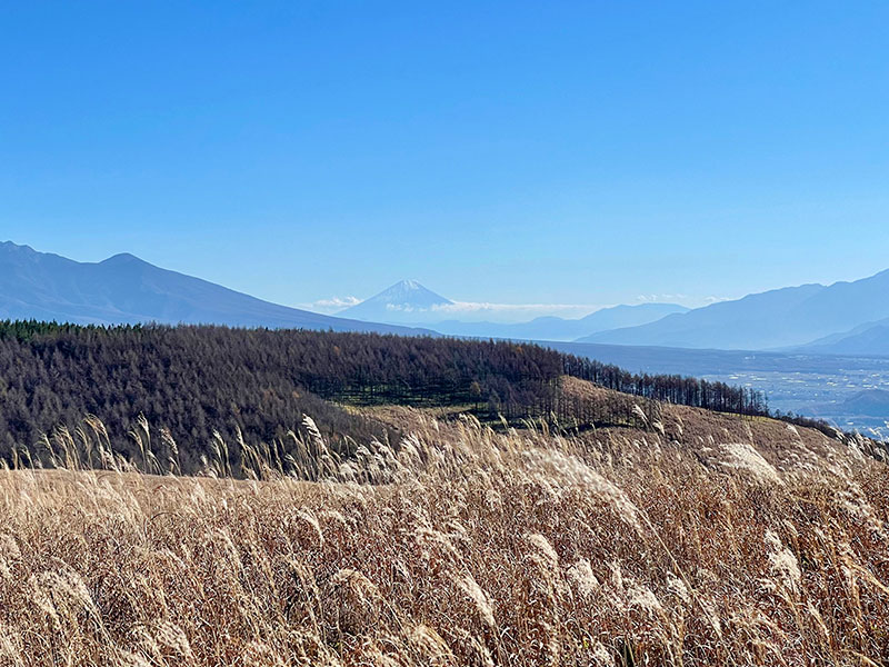
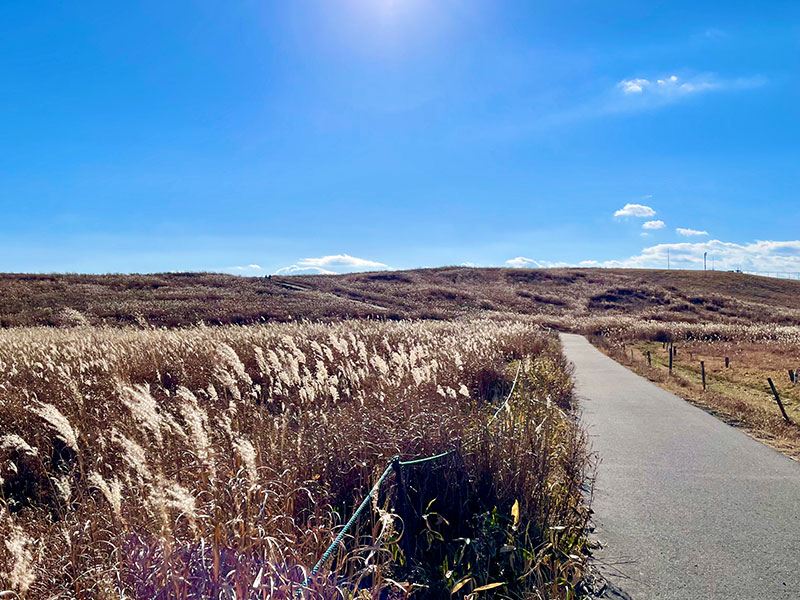
Kirigamine Fujimidai
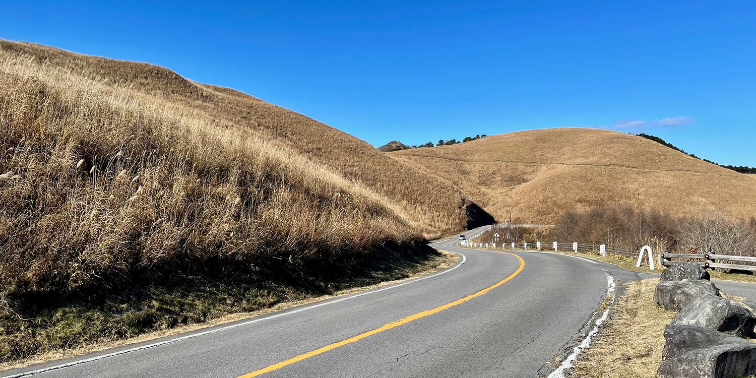
As you drive further, take in the fall-colored meadow on your right and the distant mountain range on your left before reaching a parking lot with a small restaurant called Kirigamine Fujimidai.
Fujimidai means a hilltop with a view of Mt. Fuji, and there are many Fujimidai all over Japan, but few of them offer such beautiful views of Japan’s tallest mountain. In the foreground, Japanese silver grass sways in the fall breeze.
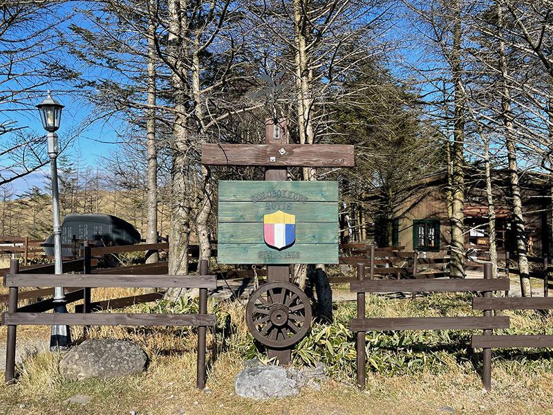
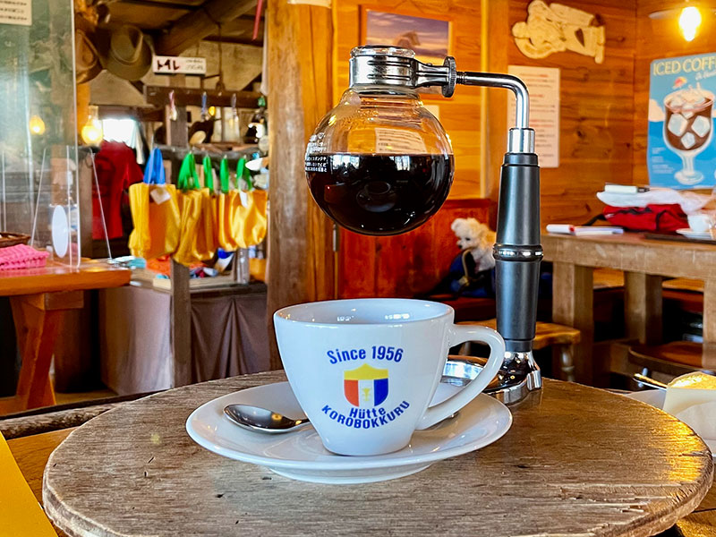
Korobokkuru Hutte
About one kilometer from Kirigamine Fujimidai is a mountain lodge called Korobokkuru Hutte. Before the snows fall, it operates as a café, serving its signature coffee brewed with a siphon coffee maker. There’s something about the taste of coffee in a highland log cabin that is especially delightful. The café’s cozy interior offers respite from the chill on colder days, and the outdoor terrace looks out on excellent views of the surrounding mountains.
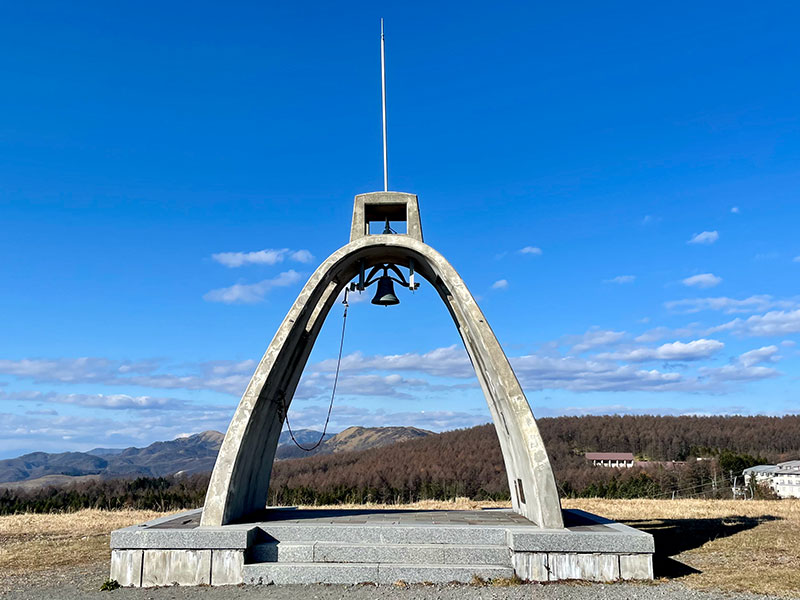
Mushoto Tower
Just beyond Korobokkuru Hutte is Drive-In Kirinoeki. It has a restaurant and other facilities, and you can park to stretch your legs for short walks around the area.
Walking along the promenade surrounded by Japanese silver grass, you'll see an arched tower. Called Mushoto, it is used on foggy days to help hikers orient themselves by the sound of its ringing bell. From here, you can see a panoramic view of Mt. Fuji and the Yatsugatake mountains.
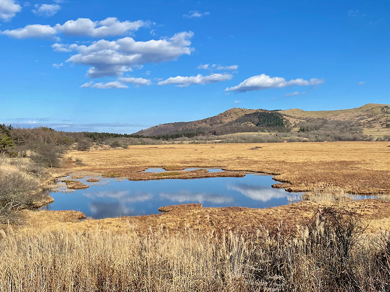
Yashimagahara Wetland
Towards the end of the drive, stop at the Yashimagahara Wetlands.
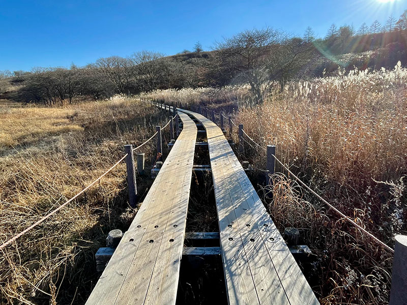
After parking and walking through a short tunnel, a vast marsh appears suddenly before you. Spring and summer are popular times to visit because of the rare flowers that bloom, but the fall offers its own kind of beauty. The shining, mirror-like surface of the water reflects the blue sky and clouds.
Formed 12,000 years ago, the Yashimagahara Wetlands grow by about 1mm per year. Flat, wooden boardwalks extend along the marsh, making it easy to walk around. It takes about 90 minutes to complete the 3.7km lap.
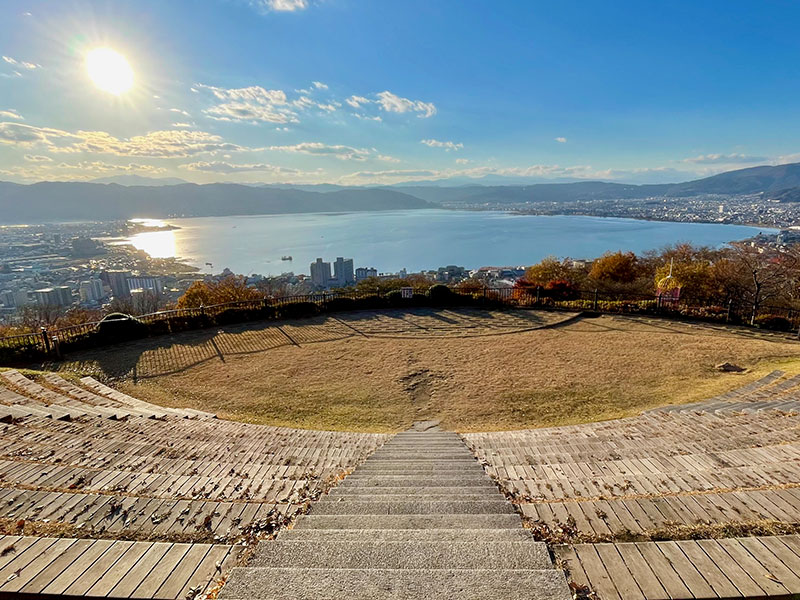
Tateishi Park
The Venus Line route stretches further north from Yashimagahara Wetlands to Utsukushigahara Museum of Art. However, if you take a detour and go back to the Suwa Interchange, along Lake Suwa, you can visit Tateishi Park. It is a popular destination for its panoramic view of Lake Suwa, and in the evening, the beauty of the setting sun reflecting off of the lake leaves a lasting impression.
Wrap-up
Beginning from the Suwa IC at around 10:00 a.m. and returning close to 4:30 p.m., the drive took about six and a half hours in total. It's a fantastic course with stunning views at each stop, and once you've finished it, you'll want to come back next season too.